
More 2020 LiDAR released on the Iowa Geographic Map Server
Eight more counties in southwest Iowa have been added to the 2020 LiDAR services: https://arcg.is/1PfriS

Eight more counties in southwest Iowa have been added to the 2020 LiDAR services: https://arcg.is/1PfriS


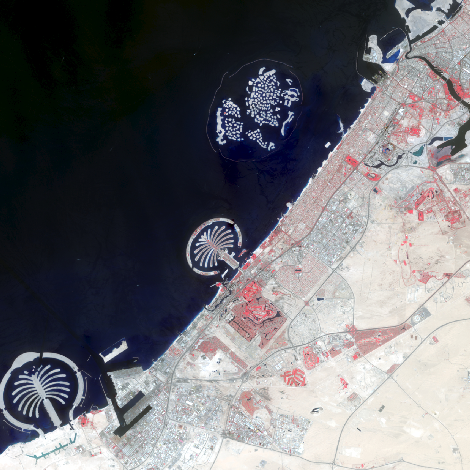
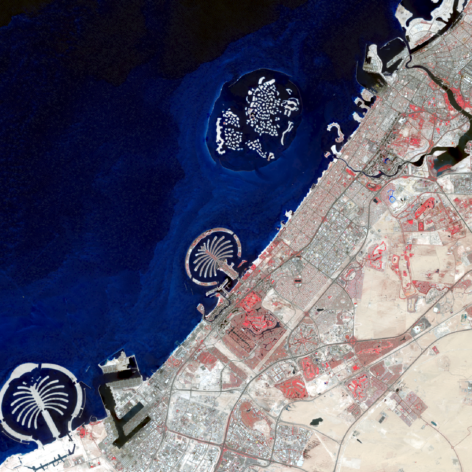
Over the last 50 years, the city of Dubai, in the United Arab Emirates, has transformed from a small fishing and pearl diving village into a luxurious, modern metropolis. The population has grown from just over 100,000 residents in 1972 to an estimated 2.9 million residents in 2022. While the beauty and distinction of this city is undeniable, some question the sustainability of this fast-growing city located in a land of desert and salt water. The images are shown in false color infrared. Areas appearing red show healthy vegetation. Notice the dramatic change from first image in 1973 (very little vegetation and urbanization) to 2022 with many areas of red far from the water.
To create these images, individual bands were downloaded from the United States Geological Survey’s Earth Explorer Website (https://earthexplorer.usgs.gov/) in April 2022. The composite false color infrared images were created in ArcGIS Pro using the composite imagery processing tool.
This year we are celebrating 50 years of the Landsat earth observing satellite mission. Landsat data helps us observe changes in our communities and environment over time.
This year marks the 50th anniversary of the launch of the first Landsat satellite (July 23, 1972). To celebrate fifty years of earth observation, IowaView will be posting various images and gif documenting Landsat in Iowa and around the world. Check back regularly for new images and articles. #TimeLapseTuesday #ThrowbackThursday


The Ladies of Landsat have shared some great USGS case study videos showcasing the paths women and girls can take to become remote sensing scientists. Three scientists stories are highlighted: Jill Deines, Africa Ixmucane Flores-Anderson, and Nikki Tulley. Read more and enjoy their stories below:
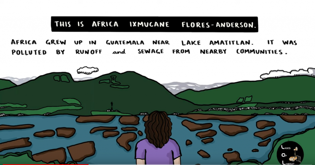
Africa Ixmucane Flores-Anderson: Using Landsat to Connect Pace to Village – Africa was inspired to help her local community in Guatemala by mapping water quality with Landsat and is now at monitoring deforestation.
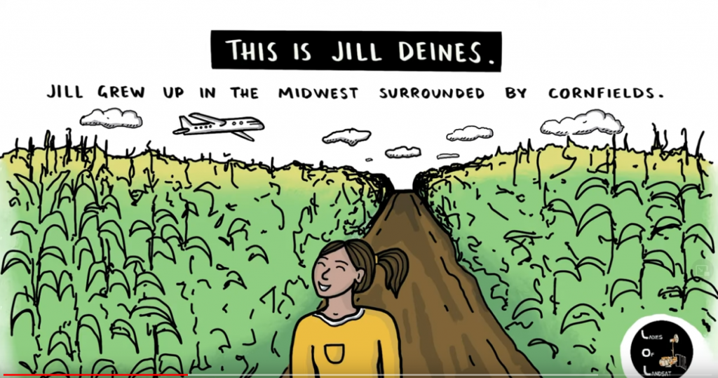
Jill Deines: Using Landsat to Map Agriculture Yields and Irrigation Use – Dr. Jill Deines was was drawn to the bird’s eye view of agriculture plots growing up in the Midwest. Now she uses Landsat to monitor water resources and crop yield.
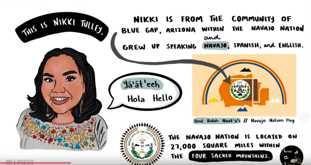
Nikki Tulley: Speaking a New Language of Landsat – Nikki grew up in the Navajo Nation without running water in her household. As PhD student at University of Arizona and Indigenous scientist, she uses Landsat to track drought conditions in her home community.

Yesterday the United State Geological Survey (USGS) released the first 38,000 scenes collected from the recently launch Landsat 9 (September 2021). After much calibration and quality assurance here are some of the first clear images of Iowa. For more images visit USGS Earth Explorer: https://earthexplorer.usgs.gov/.


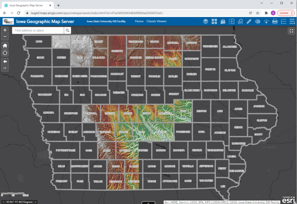
The ISU GIS Facility Manager, Robin McNeely, recently gave a presentation for the Iowa Geographic Information Council Lunch and Learn series about new data products that the GIS Facility has been producing. Here is a link to watch Robin’s presentation, which begins around (29:20): https://iastate.webex.com/iastate/ldr.php?RCID=64ed815f6c8eaa323fa5c88cc36d7d60.
She highlighted the completion of the Historic United States Geological Survey (USGS) 24,000 Topographic Map series ArcGIS service. The 24k historic topo maps were downloaded from the USGS TopoViewer as georeferenced .tif files, inventoried and put into an ArcGIS mosaic dataset. The dates for those maps for Iowa are 1949-1986. They are currently in a published map service on ortho.gis.iastate.edu and as a layer in the Iowa Geographic Map Server (see map below.)
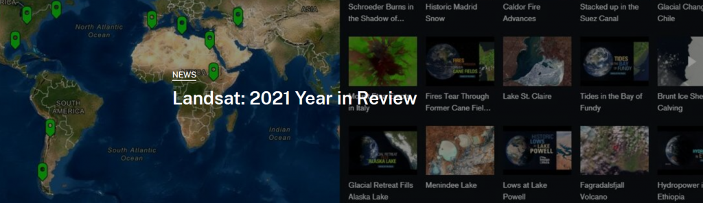
USGS just released a Story Map summary wrapping up 2021 and the exciting developments with the Landsat mission including a newly launched satellite and 10 million scenes in the archive mark two high points.
Here’s the link to explore it yourself: https://geonarrative.usgs.gov/launching-into-a-new-year/
Web services providing 2020 LiDAR for more of the state have been published. To date about 28 counties have been completed.
The Iowa Orthoserver (also known as the Iowa Geographic Map Server) has a variety of resources available to enhance and serve users. Today we are highlighting the Aerial Photo Dates layer. This layer allows users to determine the date of a particular image.
Here are the basic steps to using the Aerial Photo Dates layer in the Iowa Geographic Map Server ArcGIS Web App:

The statewide 2021 NAIP flight date layer is not yet available. This will be released when the layer is available. If you would like information regarding specific areas for the 2021 flight, please contact Amy Logan.
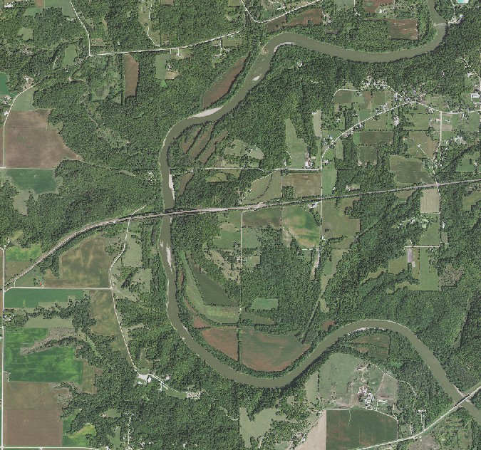
Iowa Statewide summer 2021 imagery is now available as a webservice from the Iowa Geographic Map Server. https://ortho.gis.iastate.edu/arcgis/rest/services/ortho
Please note: you may have to adjust the symbology to get the best color.
Here are some suggestions for doing this is ArcGIS Pro, within the Symbology tab, use the dropdown menus to adjust the color.

