When: September 21st, 2021 8:00 PM through 9:00 PM (Eastern)
Attention educators and mappers! Join TeachOSM Tuesday, 21 September for our first ever ‘back-to-school’ night. We’re offering an informal open house to introduce our programming. This hour-long event will feature brief demos from teachers and mappers to enable you to:
Find out more about how you can put OSM in your school
Learn how to take advantage of our Map-Alongs and other educational programming
Find out how you can get support open mapping education in your community
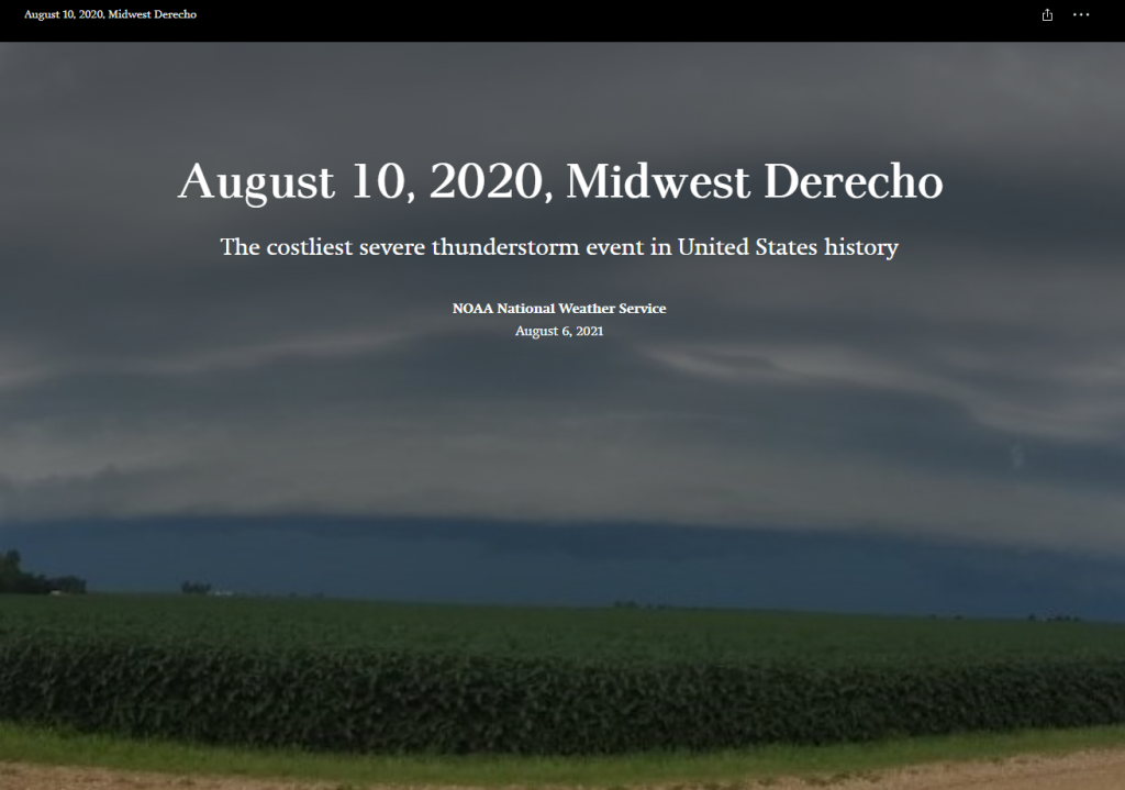
A year ago today a derecho, a series of thunderstorms with hurricane-like winds and heavy rains, struck Iowa with very little warning. The National Oceanic and Atmospheric Administration (NOAA) put together a multi-media story map to tell the tale of this eventful day. Hundreds of thousands of trees were lost or damaged. Homes and buildings were destroyed. Many people lost power for days or even weeks.
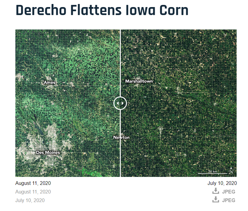
Have you visited the NASA’s Earth Observatory? It is a NASA website that helps make satellite imagery relevant to the general public and it is a great place to find images for presentations or use in the classroom. In August 2020, the Earth Observatory featured a comparison of satellite images from July 2020 and August 2020 to show the extent of the derecho damage on Iowa cropland.
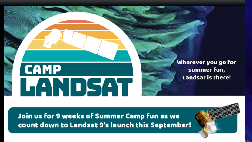
Each week NASA’s Landsat Science team will explore a unique aspect of Landsat earth science (see themes below). Weekly features include Landsat related crafts and games, revisiting each sequential Landsat mission as well a weekly postcard from camp. Stop by each week of camp to explore a new theme.
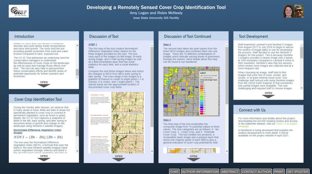
IowaView staff have released the Cover Crop ID Toolbox and Handbook. This toolbox allows users to quickly identify possible cover crop fields using three Sentinel-2 images from the fall, early spring, and late spring downloaded from the Earth Explorer website based on field boundaries supplied by the user. On the project webpage you can download the toolbox which works with both ArcMap or ArcGIS Pro as well as the Cover Crop ID Toolbox Handbook that provides additional details about each step of the tool.
This year NASA’s Earth Day theme is #ConnectedByEarth. Visit the NASA Earth Day Poster website to watch a short video about the inspiration for the poster and discover the gems hidden within the poster. Download your copy of the poster to learn more about bees and our natural world.
This year IowaView Staff are presenting their research at a virtual university research conference. Staff built a poster using a tool called iPoster. Click on the poster below to interact with the virtual poster (available for a limited time, through March 2021).
As a way to celebrate GIS Day and OpenStreetMap, we are encouraging everyone to go online either during this week or on GIS Day and contribute to the OpenStreetMap basemap. You may consider improving the basemap in your own community. Here are several projects to consider:
Public Lab Mongolia – https://tasks.hotosm.org/projects/9560/ Public Lab Mongolia (PLM), a local non-governmental organization in Mongolia, is leading the Mongolian chapter for volunteer mappers through the HOTmicrogrant COVID-19 project, as part of their mission to promote open data and disaster preparedness. This mapping will also help with COVID-19 response efforts. This project is to map Ulaanbaatar capital city of Mongolia, is organized by PLM in collaboration with the Mongolian Geo-spatial Association and local universities.
Hurricane Eta – Nicaragua – https://tasks.hotosm.org/projects/9765 Hurricane Eta brought wind, rain and storm surge to the coast of Nicaragua. This project is to finish the basemap of Bilwi (Puerto Cabezas) by digitizing buildings from MAXAR imagery. Available to beginners, there may be tricky tasks in this project as some areas have been partially mapped with older imagery and vegetation can often hide parts of structures. Make sure to review the instructions for tips on how to overcome these challenges and provide high quality data.
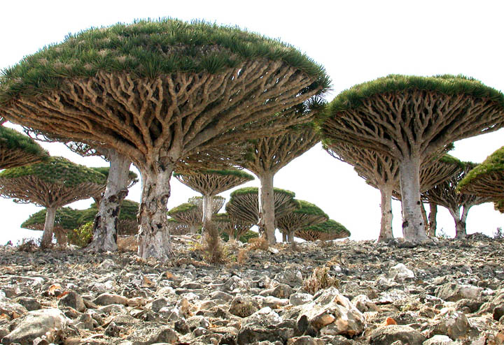
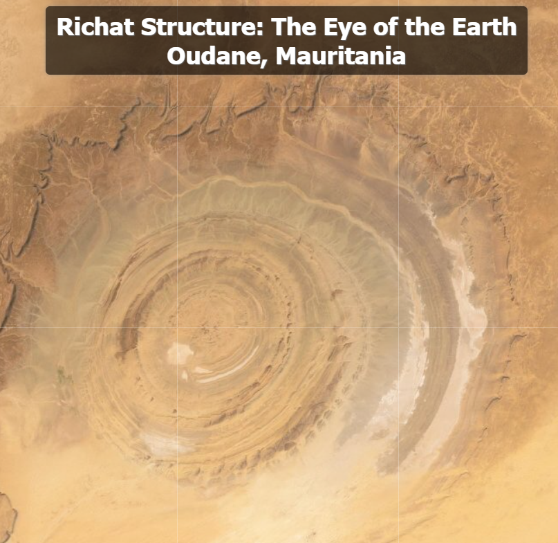
Today we will be joining Joseph Kerski, a Geographer and GIS education enthusiast, exploring Weird Earth: Exploring the Earth with Interesting, Bizarre, and Odd Imagery. Joseph provides a narrated video on Youtube (primarily targeted at educators) but you can also explore these fascinating places on your own using this ArcGIS Online map. Thank you, Joseph, for taking us to new places and uncover hidden gems on our planet!
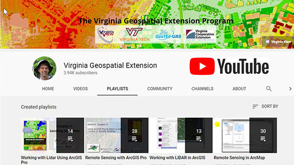
VirginiaView, in partnership with Virginia Tech and other partners, recently published a new video tutorial series called “Working with Lidar Using ArcGIS Pro”. This resource is appropriate for 2-year and 4-year college faculty who would like to integrate additional online (and self-paced) educational resources with their courses.
Previous tutorial topics have also been popular with geospatial professionals who are seeking a cost effective and self-paced opportunity to sharpen their geospatial skills. The new tutorial series (and other topics listed below) might be appropriate for professionals working with local/regional/state/federal governments, as well as in the private sector.
This week marks 40 years since the Mount St. Helens eruption. The image above is from the USGS Earthshots trading card series. The images are displayed in color infrared which is useful for showing living vegetation in red. The mountains surrounding Mount St. Helens are primarily forest. Notice the extreme change in the landscape from the 1973 image to the post eruption image in 1983. The damage was extensive and ash covered much of the surrounding forest land.