Category Archives: Imagery

Mother Earth As Art – Virtual Art Exhibit

Dr. Chandana Mitra of AlabamaView along with other member of her team are hosting “Mother Earth as Art”, which features USGS Earth as Art images as well as other inspired images, at the Jule Collins Smith Museum of Fine Art at Auburn University during Spring 2020. The exhibit is also available online. Here is the link to explore the exhibit: http://jcsm.auburn.edu/exhibitions/mother-earth-as-art/.

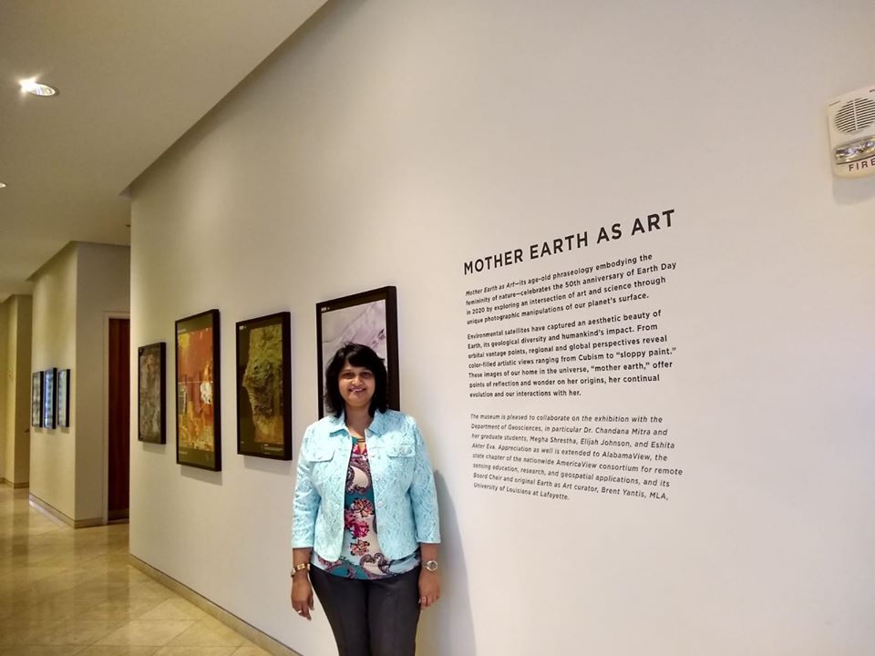
Dr. Mitra, two of her graduates students,along with the art museum curator, Christy Barlow discuss the exhibit in an online gallery talk which was presented live on Earth Day, April, 22, 2020. Here is a link to view the gallery talk: https://www.youtube.com/watch?v=UPtBDZF0DRM&feature=youtu.be

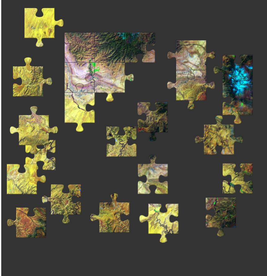
Below is a preview of the some of the images.

Experience the beauty of our planet on #EarthDay. We're hosting Earth Day Live: "Mother Earth as Art" at 1 p.m. CT with the Auburn University College of Sciences and Mathematics and the Auburn University Geosciences Department. Explore how this #STEAM exhibition came together and have an online conversation.

Posted by Jule Collins Smith Museum of Fine Art on Wednesday, April 22, 2020

Are you up for a challenge?

AmericaView has a series of over 70 Earth image puzzles to encourage people of all ages to engage with satellite imagery and learn more about remote sensing by offering a fun challenge. The puzzles can be made to match ability or time available by choosing the number of pieces from 12 to 110 pieces. There are also options that allow the pieces to be shuffled or the border to be completed.

Any way you choose, check out these puzzles.

Canyonland – 25 piece puzzle

Google Earth Engine Tutorials

Google Earth Engine is a platform for exploring and analyzing satellite imagery. It is available for academic, non-profit, business and government users.

Several members of the AmericaView community have created tutorials to provide a foundation to quickly begin learning and using Google Earth Engine (GEE). If you are new to GEE, you will want to start with this Google Earth Outreach tutorial. You may need to sign-up for a GEE account with an existing Gmail email address.

For a list of additional tutorials visit the AmericaView GEE Tutorial page: https://americaview-old.ssec.wisc.edu/program-areas/education/google-earth-engine-tutorials/.

USGS Earthshots: Satellite Images of Environmental Change

The USGS has produced an amazing collection of images (also available as trading cards!) that show Earth’s change over time. The Earthshot collection has a wide variety of examples of change over time including:
– natural phenomena changes (glaciers, deserts,)
– social change (city growth,)
– human interaction with the natural world (mining, deforestation, agriculture,)
– natural disasters (hurricanes, tornado damage, flooding.)

Below are two examples of the trading cards, Mount St. Helens pre/post volcanic explosion and Las Vegas, Nevada population growth over time.

If you view a location on through the browser you will get about 5 images you can review as well as context about the images.

Other Resources: Tracking Change Over Time (teacher guide): https://pubs.usgs.gov/gip/133/pdf/tracking-packet_web.pdf
Lesson Plan – Investigating Deforestation Throught An Earth Systems View Using Landsat: https://mynasadata.larc.nasa.gov/lesson-plans/investigating-deforestation-through-earth-systems-view-using-landsat

IowaView has trading cards available. Please contact Amy Logan for more information.

What does social distancing look like? – A View from Space

A couple weeks ago Bloomberg News posted an interesting article (click here to read the article) showing how the stay at home orders are effecting areas around the world using high resolution satellite imagery. Below is an example showing Venice, Italy on October 20, 2019 compared to March 18, 2020 after the residents were asked to stay at home. It is interesting to compare the water clarity and traffic.

Venice, Italy: Notice the change in water traffic and water clarity after the Italy began ordering residents to stay at home. Source: Bloomberg.com

The article highlights numerous sites around the globe including: Wuhan, China (before shutdown / after shutdown); Mecca in Saudia Arabia; Venice, Italy; Epcot Center in Florida, USA; Tianjin, China; and Miami Beach, Florida, USA.

Resource: What It Looks Like From Space When Everything Stops, Eric Roston, March 24, 2020, Bloomberg.com

Loess Hills: Iowa Landforms Revealed

Obscured from view by vegetation and built structures, Iowa’s often subtle landforms are revealed through a LiDAR-derived bare earth digital elevation model in a Geographic Information System. Geological and human made features can be seen in this series of LiDAR color hillshade maps from across the State.

Loess

Deep deposits of wind-blown silt define the Loess Hills region of western Iowa. Intricate drainage networks and agricultural terraces are visible in this map from along the West Nishnabotna River near Hamburg.

Click on image to explore.
This image is of part of the Loess Hills in southwest Iowa.

Algona Moraine: Iowa Landforms Revealed

Obscured from view by vegetation and built structures, Iowa’s often subtle landforms are revealed through a LiDAR-derived bare earth digital elevation model in a Geographic Information System. Geological and human made features can be seen in this series of LiDAR color hillshade maps from across the State.

Algona

The elevated curved features in this map are glacial moraines deposited during the most recent period of glaciation in north-central Iowa. The largest in this view is called the Algona Moraine.

The Algona Moraine is located in north central Iowa.

Oneota River Valley: Iowa Landforms Revealed

Obscured from view by vegetation and built structures, Iowa’s often subtle landforms are revealed through a LiDAR-derived bare earth digital elevation model in a Geographic Information System. Geological and human made features can be seen in this series of LiDAR color hillshade maps from across the State.

Oneota

Originally called the Oneota, the central river feature in this map is the Upper Iowa River. The well-defined drainage features are characteristic of the Driftless area of northeast Iowa.

Click on the image to explore in detail.
The Oneota River Valley is located in northeastern Iowa.