Category Archives: Imagery

Happy Earth Observation Day!

Gregg Hadish gave a great presentation about the Iowa Geographic Map Server to celebrate Earth Observation Day.  It was a hands-on demonstration of the Iowa Geographic Map Server ArcGIS App which meant participants could follow along as he explained the various features and functions of the map server. Gregg also showed participants how to leverage map server layers within their own ArcGIS Online organizational accounts and basics for creating their own apps. 

Thank you, Gregg for a great demo! 

Here are some pictures from our Earth Observation Day event.

Checking out the new statewide 1 ft color infrared imagery in the web app.

Gregg giving an introduction to the Iowa Geographic Map Server.

Showing a historical layer – 1880s Andreas Atlas.

Start Your Future Here – Part II

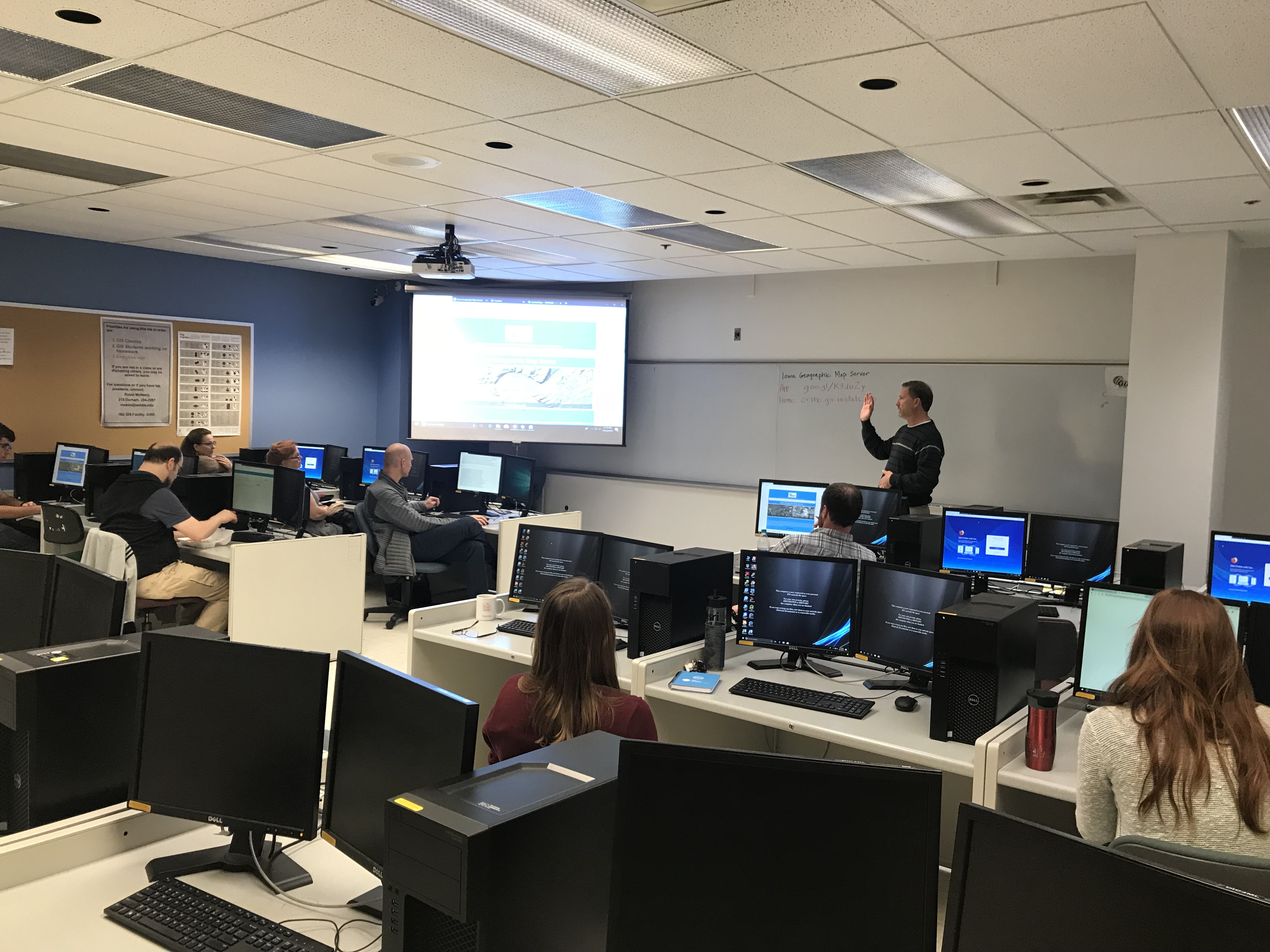
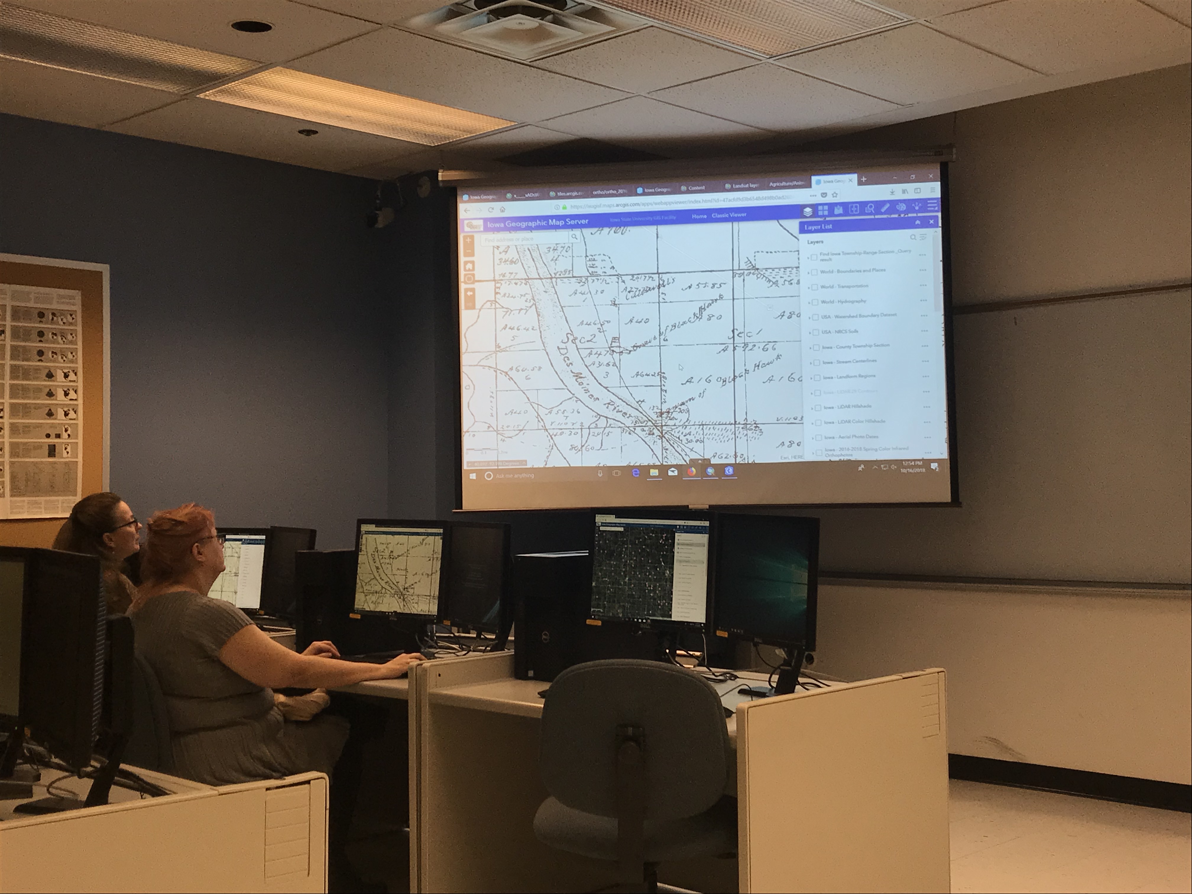
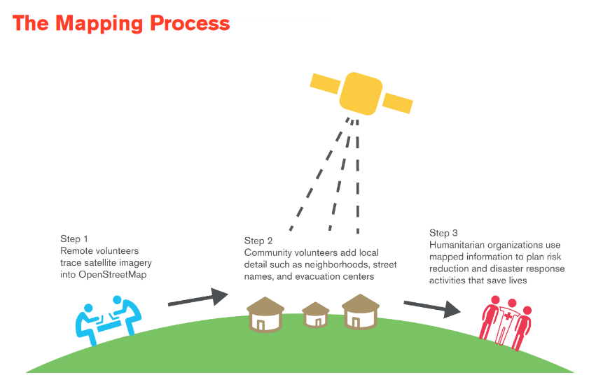
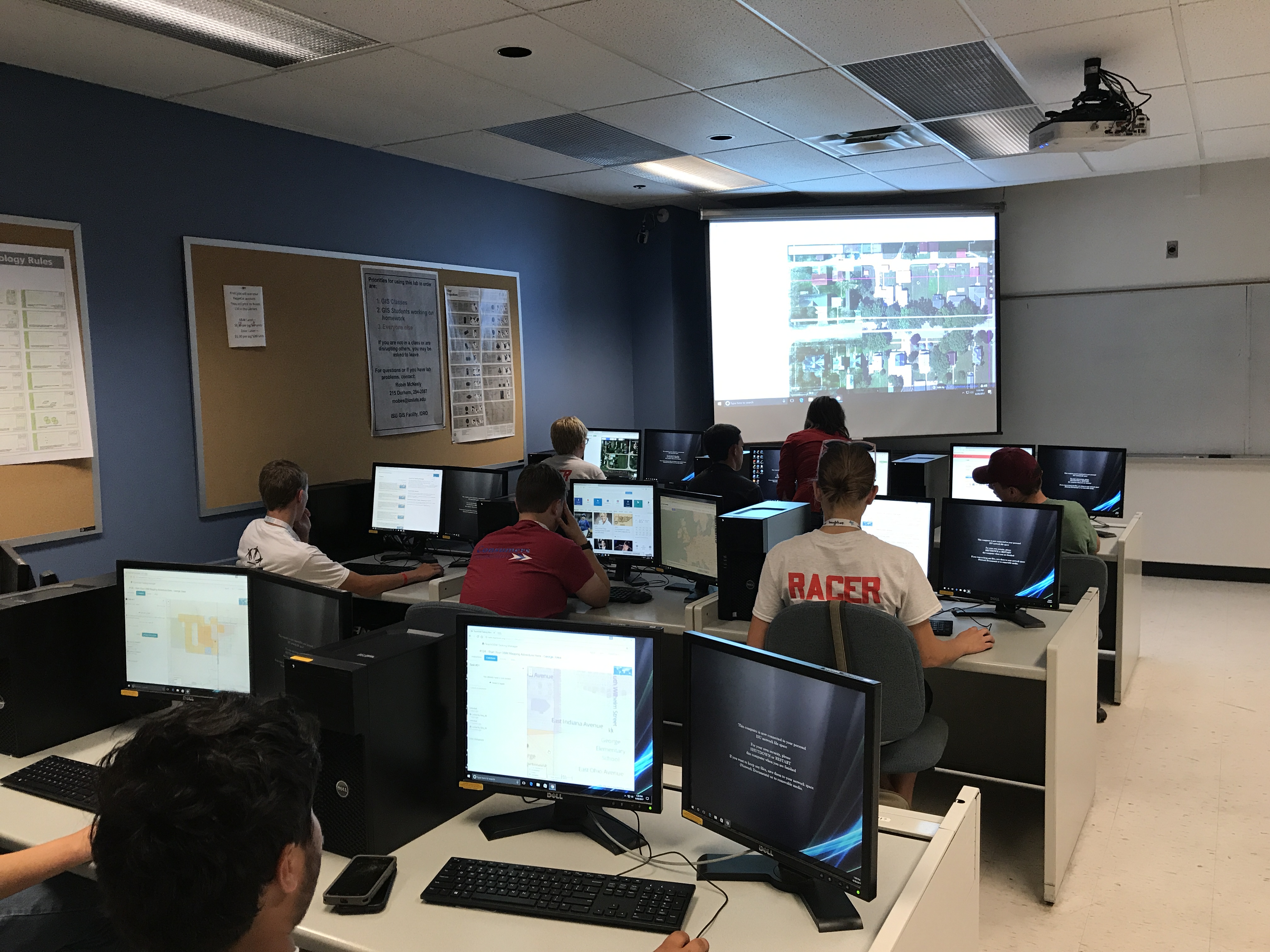
This post will describe the second workshop the ISU GIS Facility and IowaView hosted as part of the 2017 Iowa 4-H State Conference, “Start Your Future Here.”  The second workshop, “Start Your Open Street Map Adventure Here,” gave students a brief introduction to GIS and remote sensing as well as a short discussion of open street map and its interface. Then 4-Hers were asked to practice using the mapping interface through the TeachOSM application.  The group started by mapping a small northwest Iowa town, George.  As you will see from the screen shots, the 4-Hers made significant progress for this community, mapping over 400 buildings.  Comparing the before and after pictures, notice the large number of buildings added in the central and northeast parts of town.

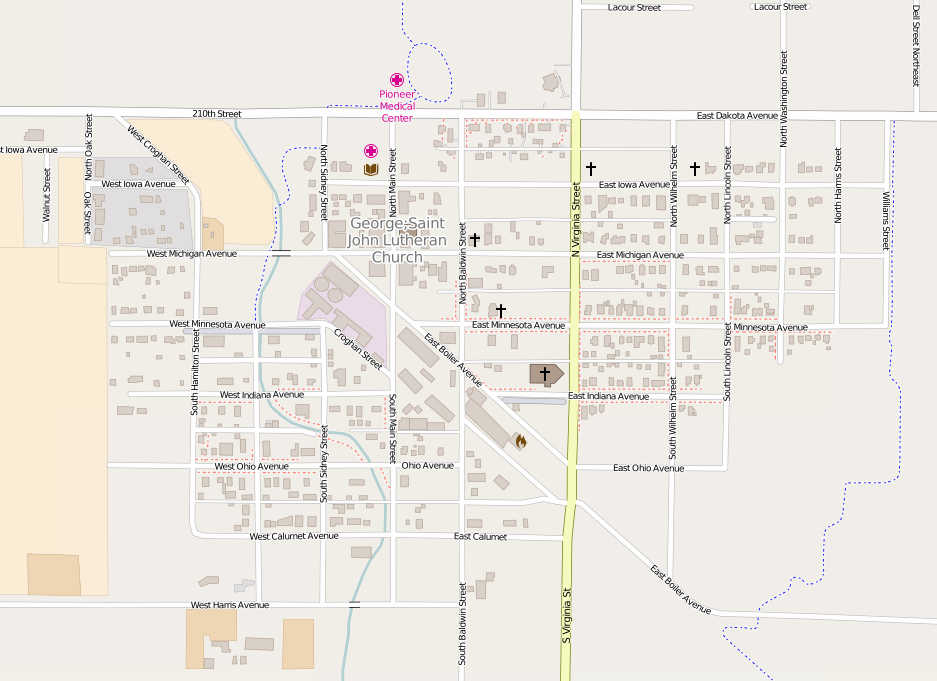
George, Iowa – Before 4-H Workshop

George, Iowa – After 4-H workshop 6/29/2017

For the second activity, students worked on a project sponsored by the United States Geological Survey (USGS)’s Volcano Disaster Assistance Program (VDAP) to help map communities near active volcanoes.  the 4-Hers mapped roads, buildings, and rivers in several small communities near Mt. Galeras in Columbia as part of their emergency preparedness. According to project description
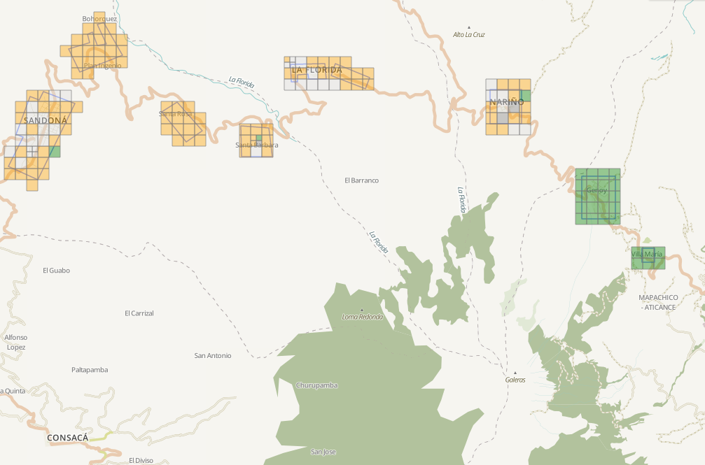
, “Galeras is an active Andean stratovolcano that is located in the Narino department, near Pasto (population: 450,000 Colombians). Galeras is the most active volcano in Colombia and is known for regular eruptions, the most recent occurring in 2000, 2002, 2004, 2005, 2007, and 2010.” The students did a great job mapping with both projects. Between the two projects over 500 nodes were created and over 3,000 nodes were created. Hopefully these activities will lead to future mapping interest.

Earth Week 2017: Story Maps

Another way to connect with our world this Earth Week is to experience an ESRI Story Map.  Story maps use maps, map animations, photographs, sounds, and video to tell compelling stories on all sorts of topics.  The lastest maps on the Story Map website are beautiful and interactive applications for storytelling.  

This month’s featured Story Map is called Embattled Borderlands.  It begins by asking the question, “Will the border wall strike a fatal blow to one of the most imperiled wild regions in North America?”  It tells the story of the US-Mexico border, taking participants to various locations along the border. The Story Map explains the unique ecosystems and creatures located along the border and how creating an intensified artificial barrier in this region could potentially impact these areas. There are also a series of vignettes about how human intervention has already had a negative impact on the land.  This Story Map is filled with brilliant photography.

To experience this Story Map for yourself visit: https://storymaps.esri.com/stories/2017/embattled-borderlands/index.html


Have you visited Earth as Art yet?

Don’t miss your chance. This is a unique opportunity to see a melding of art, science, geography, and technology here in the Ames community.  Come see some great art.  

Kids and adults can stop in to make a color wheel or model of a Landsat satellite or search the images to complete the scavenger hunt.  The exhibit is running through Sunday, February 26, 2017.

Hours:
Thursday 4-7 pm; Friday 2-5 pm; Saturday 11 am -5 pm
Sunday Feb 19 & 26, 2-5 pm

Read more about the exhibit HERE.

Earth as Art Exhibit opens!

The opening reception for the Earth as Art exhibit is on February, 2, 5-8pm. Several younger visitors were in attendance.  They created model satellites, color wheels, and searched the gallery to complete the scavenger hunt.  There was gallery talk at 6:30 pm by Brent Yantis, the LouisianaView director and the exhibit collection curator, he explained how the images were selected and shared some of his favorite images with us. 

There was a reception of crudites and cheese as well as a King Cake that was brought from Louisiana. The King Cake tasted like a cross between a glazed doughnut and a cinnamon roll, filled with chocolate and cream filling. LouisianaView and IowaView are part of the larger AmericaView, nationwide consortium for remote sensing education, research, and geospatial applications.

Please join us – Thursday, February 2, 2017

IowaView and ISU GIS Facility will be hosting an art exhibit in the Design on Main gallery in February.  It will be a unique exhibit that is a fusion of art and science – we hope that the exhibit will inspire viewers with beautiful images from around our planet and also provide a platform for education (satellite imagery, geography, earth science, physics, and art.)

The opening reception for the exhibit is on February, 2, 5-8pm. We are planning to have a gallery talk at 6:30pm by Brent Yantis, the AmericaView collection curator as well as refreshments. AmericaView is a nationwide consortium for remote sensing education, research, and geospatial applications. For additional details visit our Earth as Art exhibit page.

Don’t Forget to Register to do something Awesome (OSM)!


JOIN US THIS MONDAY, JANUARY 16, 2017 FOR the 3rd annual OSM MAPPING PARTY in Durham Center 206.

This is a fun service project.  Come meet some new people, do some good (mapping) and eat pizza!

MLK Jr. Day OSM Mapping Party Monday January, 16, 2017 from 10 am to 1pm, Durham 206 –

Please RSVP: iowamapgive@gmail.com.
Click here for more information
.

Earth as Art Exhibition – February 2-26, 2017

The ISU GIS Facility is bringing an art exhibit to Ames! Earth as Art features beautiful Landsat prints selected from the four Earth as Art collections. We are also producing some k-12 educational activities for our younger gallery visitors to enjoy. The opening reception for the exhibit is on February, 2.  We are planning to have a gallery talk by the AmericaView collection curator as well as refreshments. Gallery hours are: Thursday: 4 to 7; Friday: 2 to 5; Saturday 11 to 5.  We are also interested in scheduling additional hours by appointment, please contact amylogan@iastate.edu for more information.

We hope to see you there!


2016 Imagery available for Eastern Iowa!

Spring 2016 ortho imagery is now on the Orthoserver – http://ortho.gis.iastate.edu/.  ISU GIS Facility staff created natural color, color-infrared, and 4 band image services for the spring 2016 aerial flight of the eastern half of Iowa.  The source resolution is 1 foot.  The services can be found at: http://ortho.gis.iastate.edu/arcgis/rest/services/ortho . 

2016-ortho