IowaView Staff Make STEAM at Art Educators Fall Conference


Art Educators of Iowa website: http://www.artedia.org/
Archive of 2022 AEI Conference: https://docs.google.com/document/d/1O5poy2HMwH1LoF0XTq_mX1E4SKHxuMVDep5ffEG1vZU/edit?tab=t.0
Art Educators of Iowa website: http://www.artedia.org/
Archive of 2022 AEI Conference: https://docs.google.com/document/d/1O5poy2HMwH1LoF0XTq_mX1E4SKHxuMVDep5ffEG1vZU/edit?tab=t.0
Iowans are working to reduce emissions by moving to renewable energy sources.


Well, it’s Water Wednesday. Today’s Landsat highlight is a time lapse video (2007-2017) showing the effect of a 2010 dam breach on the water level of Lake Delhi located in Delaware County in eastern Iowa. Notice the dramatic decrease in water and the exposure of large sandbars and the refilling of the lake as the dam is restored.

This year we are celebrating 50 years of the Landsat earth observing satellite mission. Landsat data helps us observe changes in our communities and environment over time.


To celebrate the Landsat Golden Jubilee, consider taking a virtual visit to Camp Landsat! This summer Camp Landsat is celebrating this exciting anniversary with 5 weeks of programming, celebrating the 5 decades of Landsat’s continuous mission. This week the theme is People and Places.
Enjoy and explore many activities from Camp Landsat including:

Stay Cool and Keep Observing!
Saturday, July 23, 2022 marked the 50th anniversary of the launch of the USGS/NASA Landsat earth observing satellite mission. With the launch in 1972, Landsat has continued its earth observation mission and become the longest continuous earth observing satellite.

Enjoy this video recalling the launch and explaining the beginning of the earth observing satellite mission, Landsat 9 – Part 1: Getting off The Ground: https://www.youtube.com/watch?v=FlRf17Egexo.
Keep Observing!
We are continuing our celebration of the 50th year of the US Landsat satellite imagery program. This week we are heading to the lake – Clear Lake, Iowa, located in north central Iowa.
Below are four images showing Summer Solstice (6/13/2019), Fall Equinox (9/17/2019), Winter Solstice (12/22/2019), and Spring Equinox (3/18/2019) from Landsat 8. The images are presented in color infrared which shows vegetation in red rather than green for better contrast.

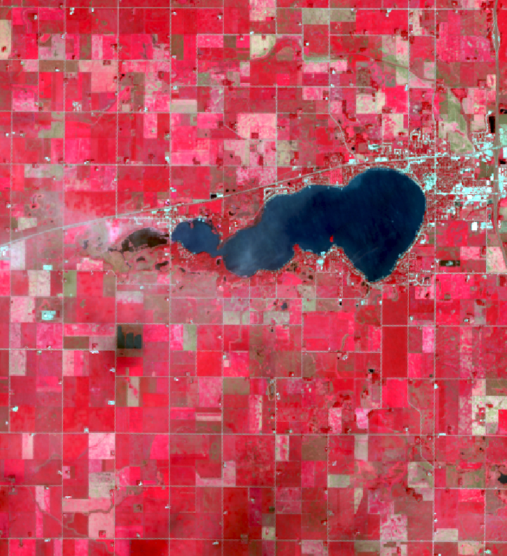
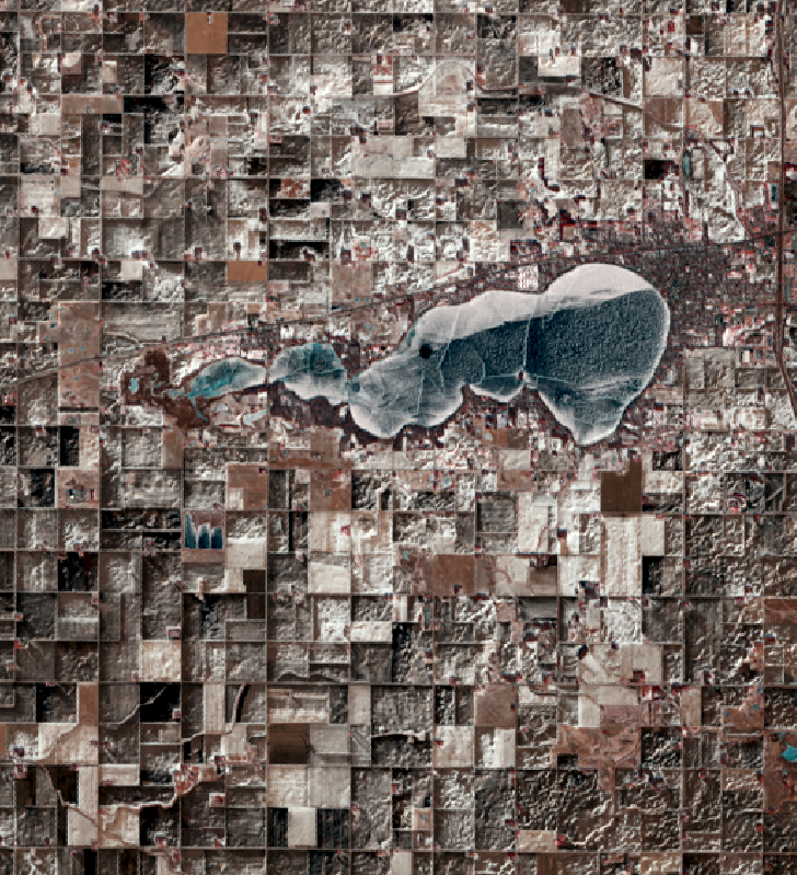

Observations:
Welcome to another Throwback Thursday. Today we are going back into the archives to compare imagery from the first five Landsat satellites (all images are featured in natural color). Click on each image for a closer view.


You can explore the raw images using this web app: https://arcg.is/0XrG4f. Happy exploring.
This year we are celebrating 50 years of the Landsat earth observing satellite mission. Landsat data helps us observe changes in our communities and environment over time.
Thanks for stopping by and keep observing the world around you!

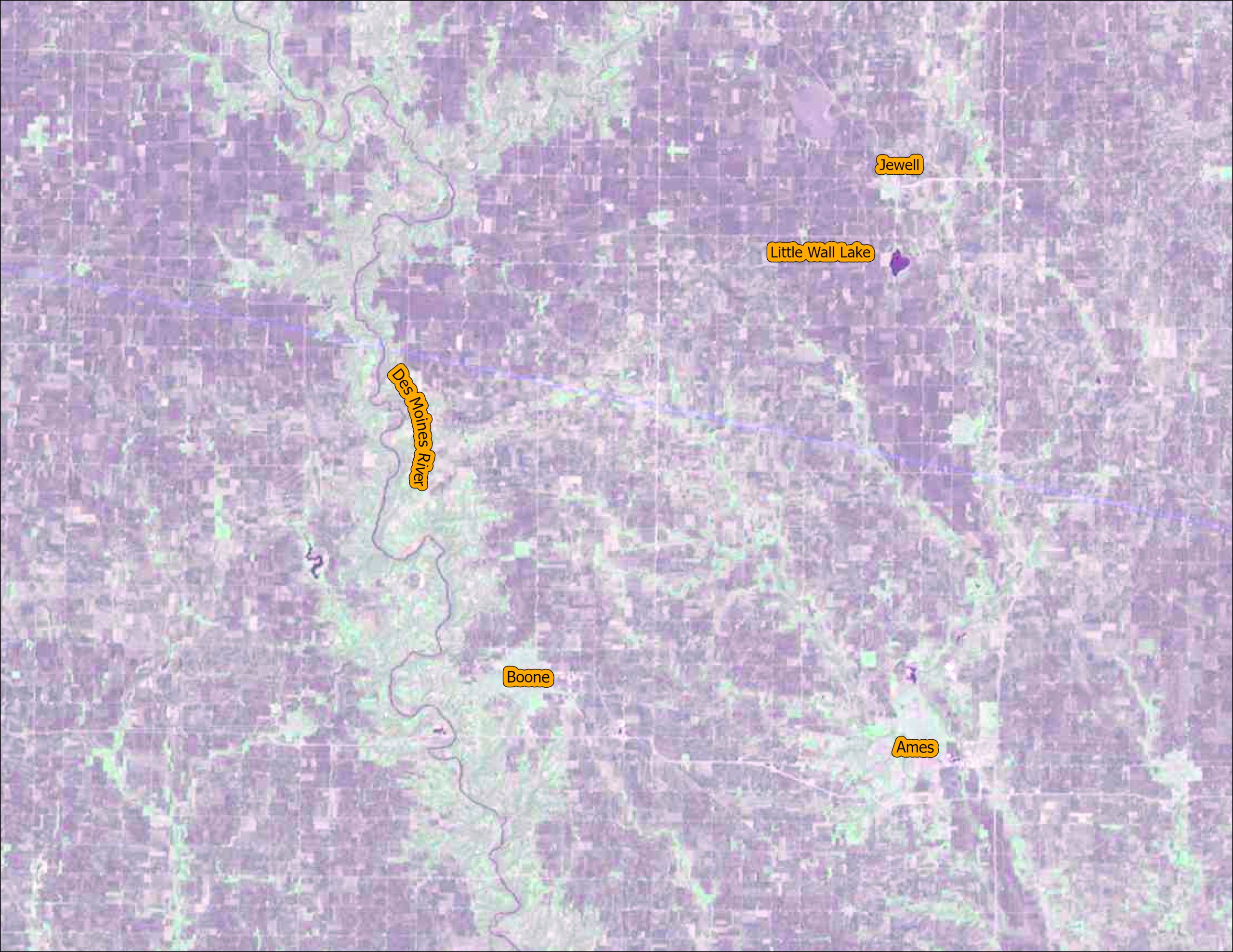
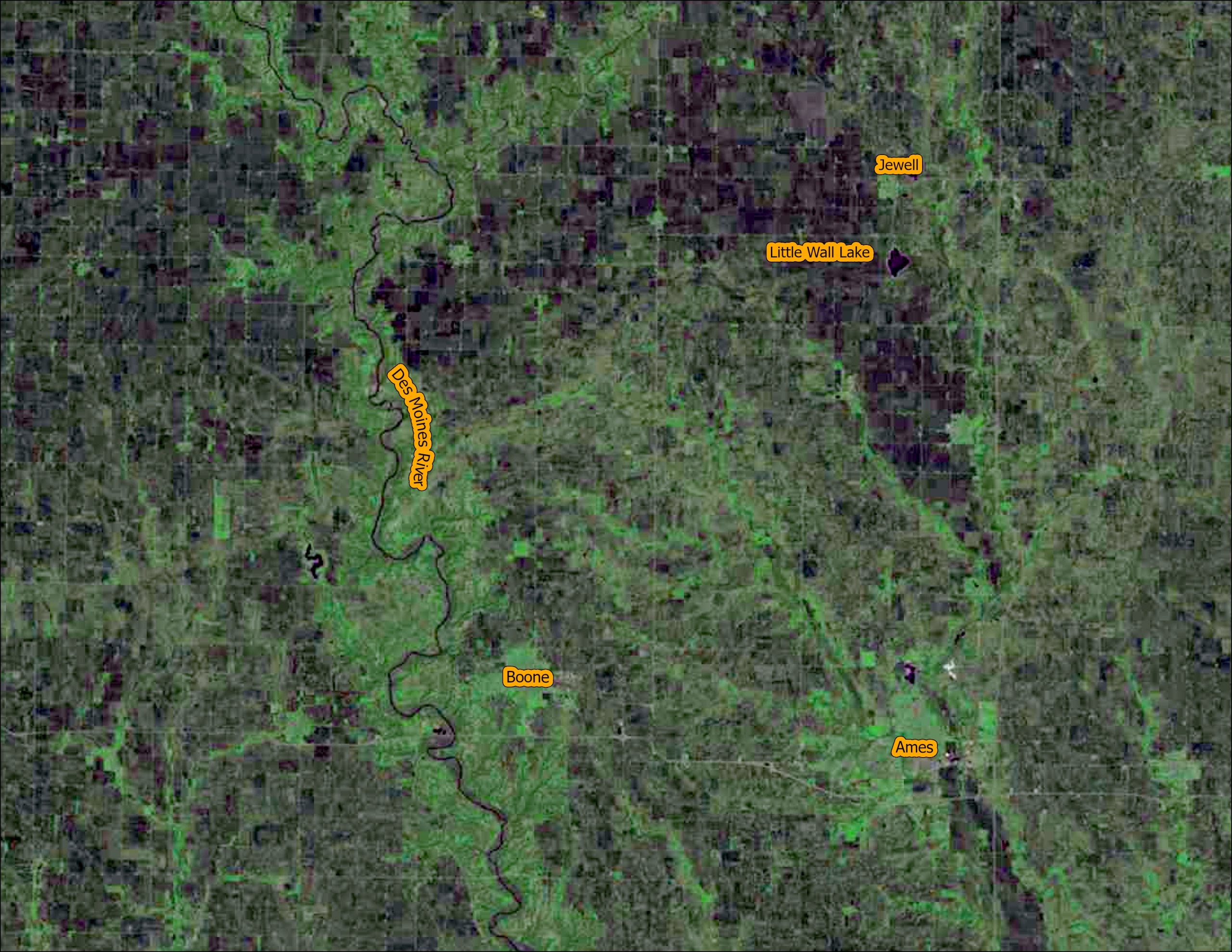
1) The areas of purple and white in the image are urban areas. Throughout the video they fill in the area from the bottom to the center. The pink areas are farm land.
2) Did you notice the increase in the number of retention ponds (dark blue specks in the urban areas) over time? Retention ponds are used to prevent flooding and provide for water storage in urban areas. As areas become urbanized there is often more surface covered in concrete, parking lots and buildings. There are fewer places for the water to flow directly into the ground.
3) Did you spot the golf course on the northern edge of the city?
This year we are celebrating 50 years of the Landsat earth observing satellite mission. Landsat data helps us observe changes in our communities and environment over time.
This video was created using Google Earth Engine. You can create your own time lapse videos by visiting: https://emaprlab.users.earthengine.app/view/lt-gee-time-series-animator.


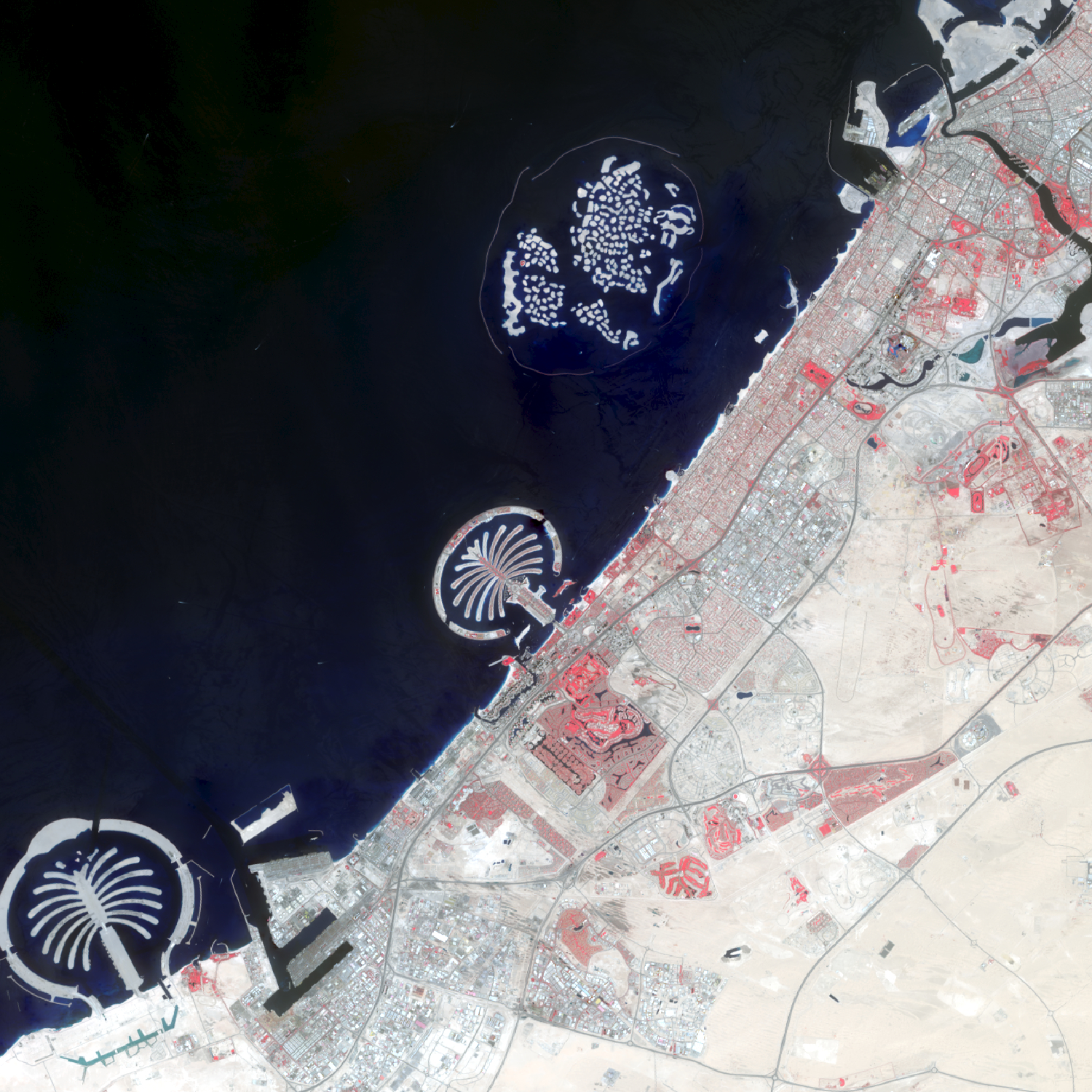
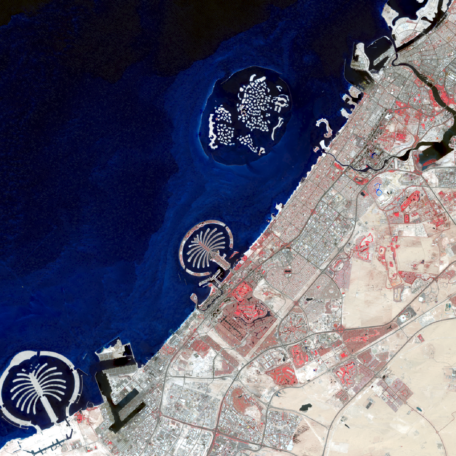
Over the last 50 years, the city of Dubai, in the United Arab Emirates, has transformed from a small fishing and pearl diving village into a luxurious, modern metropolis. The population has grown from just over 100,000 residents in 1972 to an estimated 2.9 million residents in 2022. While the beauty and distinction of this city is undeniable, some question the sustainability of this fast-growing city located in a land of desert and salt water. The images are shown in false color infrared. Areas appearing red show healthy vegetation. Notice the dramatic change from first image in 1973 (very little vegetation and urbanization) to 2022 with many areas of red far from the water.
To create these images, individual bands were downloaded from the United States Geological Survey’s Earth Explorer Website (https://earthexplorer.usgs.gov/) in April 2022. The composite false color infrared images were created in ArcGIS Pro using the composite imagery processing tool.
This year we are celebrating 50 years of the Landsat earth observing satellite mission. Landsat data helps us observe changes in our communities and environment over time.
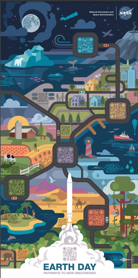
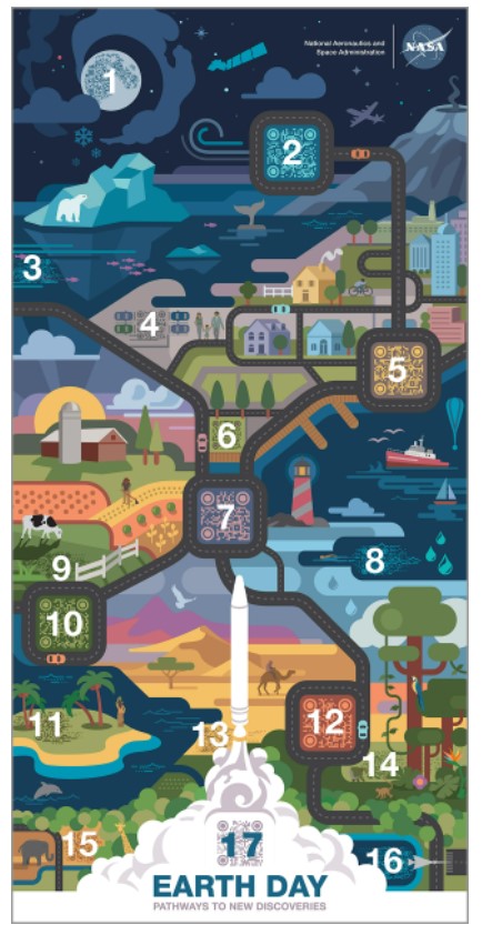
This year NASA’s Earth Day poster is features a series of QR codes which provide an array of information on a number of their missions, programs, and activities. We have provided a key below explaining each of the numbered QR codes along with the link to each code (click on the name to follow the link.)