This year marks the 50th anniversary of the launch of the first Landsat satellite (July 23, 1972). To celebrate fifty years of earth observation, IowaView will be posting various images and gif documenting Landsat in Iowa and around the world. Check back regularly for new images and articles. #TimeLapseTuesday #ThrowbackThursday
What: VIRTUAL AND IN-PERSON EVENT Virginia Tech Office of GIS and Remote Sensing Research Symposium We have an exceptional panel of speakers on hand this year representing Duke University, NASA (Emerita), and Virginia Tech. Another highlight of the Symposium, is the student poster session & web map app showcase with over 35 undergraduate and graduate student posters on full display! When: 4/8/22 @ 12pm-3:30pm (Eastern) Registration (free): https://virginiatech.zoom.us/webinar/register/WN_n0l1pRCTTSWgDeP7Jwx47Q
What: VIRTUAL AND IN-PERSON EVENT Iowa Technology and Education Connection (ITEC) Conference ITEC is hosting the annual conference on April 13-14. Join fellow Iowa educators at the state’s premier Tech Ed event! IowaView staff will be presenting on April 14 at 1:15 -2:05pm – Spreading the Mapping Bug: Sharing Geospatial Resources, Ready-to-Go Curriculum, and Mapping Activities for Teachers to Use Tomorrow and Integrate into Their Lessons. Great for student engagement. Many of these materials align with core standards and resources include interactive maps and apps available immediately. When: 4/14/22 @ 1:15-2:05pm Registration: https://www.itec-ia.org/conference-registration-details/
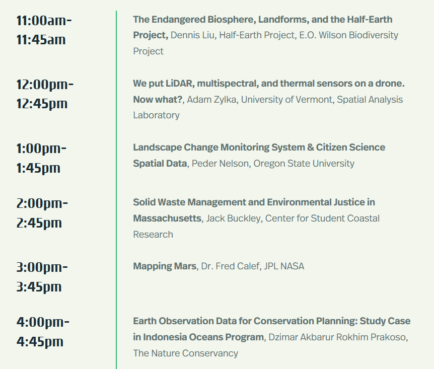
What: VIRTUAL EVENT GeoTech Center – Earth Observation Day
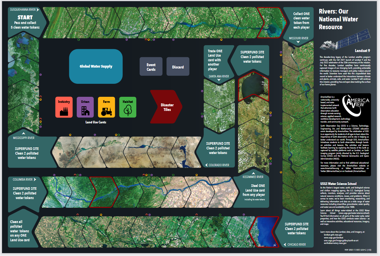
Enjoy this water themed poster “Water Today and for the Future” from the AmericaView’s Earth Observation Day Team. This poster contains the creative game experience to help bring understanding to how water resources in America are used and managed for future use. You can download the poster and you can play the game online on Tabletopia. The poster is available in Spanish.
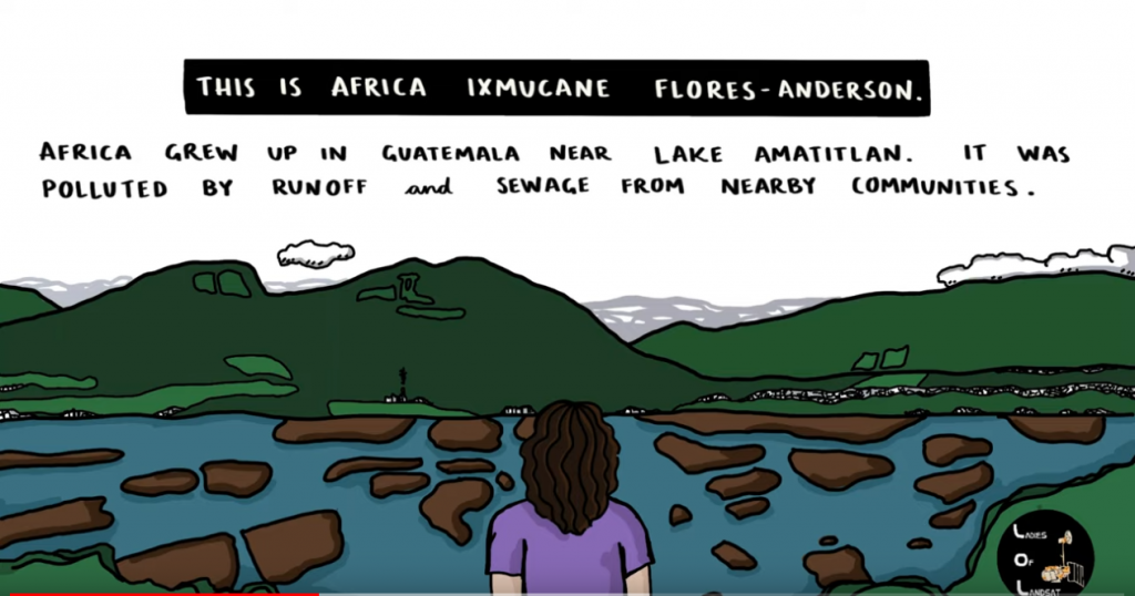
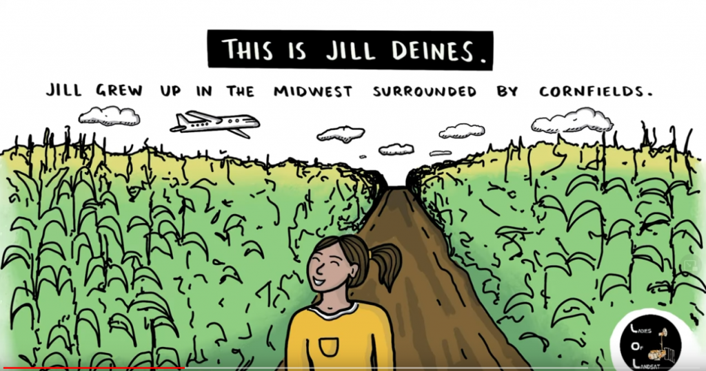
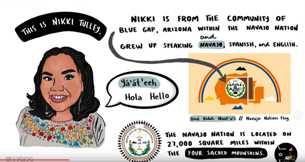
The Ladies of Landsat have shared some great USGS case study videos showcasing the paths women and girls can take to become remote sensing scientists. Three scientists stories are highlighted: Jill Deines, Africa Ixmucane Flores-Anderson, and Nikki Tulley. Read more and enjoy their stories below:
Nikki Tulley: Speaking a New Language of Landsat – Nikki grew up in the Navajo Nation without running water in her household. As PhD student at University of Arizona and Indigenous scientist, she uses Landsat to track drought conditions in her home community.
This Image was captured with Landsat 9 on December 12, 2021. Notice the snow dusting in the north part of the image.
Yesterday the United State Geological Survey (USGS) released the first 38,000 scenes collected from the recently launch Landsat 9 (September 2021). After much calibration and quality assurance here are some of the first clear images of Iowa. For more images visit USGS Earth Explorer: https://earthexplorer.usgs.gov/.
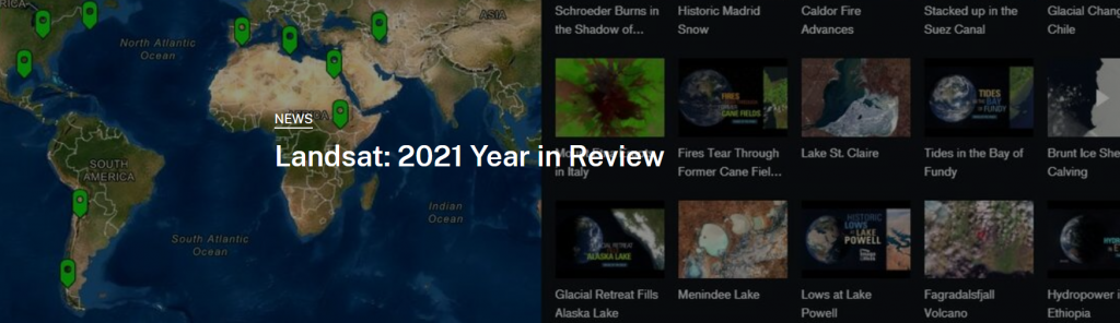
USGS just released a Story Map summary wrapping up 2021 and the exciting developments with the Landsat mission including a newly launched satellite and 10 million scenes in the archive mark two high points.
Postcards From Camp: Cities & Suburbs Are you exploring any cities this summer? Rain or shine, urban planners use Landsat to take stock of city growth and its environmental impact. The front of this postcard features a natural-color Landsat 8 image of Ocean Flower Island in Hainan, China acquired May 6, 2020.
Photo Credit: U.S. Air Force photo by Senior Airman Ian Dudley
Landsat 9 is scheduled to be launched on September 16, 2021. This will mark almost 50 years of earth observation by US satellites. In preparation for this historic launch, we will be sharing several interactive documents about the history of the Landsat mission as well as the information about the Landsat 9 mission.
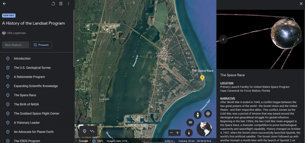
Today we would like to share with you, A History of the Landsat Program, developed by Ellie McGinty at UtahView. It’s an interactive Google Earth Tour, which documents major moments in earth observation history through a combination of maps, text, and curated images starting with the founding of the United States Geological Survey in 1879 through the birth of NASA in 1958 to the conception of Landsat in 1970 and all the way to the present day launching of Landsat 9.
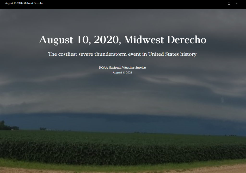
A year ago today a derecho, a series of thunderstorms with hurricane-like winds and heavy rains, struck Iowa with very little warning. The National Oceanic and Atmospheric Administration (NOAA) put together a multi-media story map to tell the tale of this eventful day. Hundreds of thousands of trees were lost or damaged. Homes and buildings were destroyed. Many people lost power for days or even weeks.
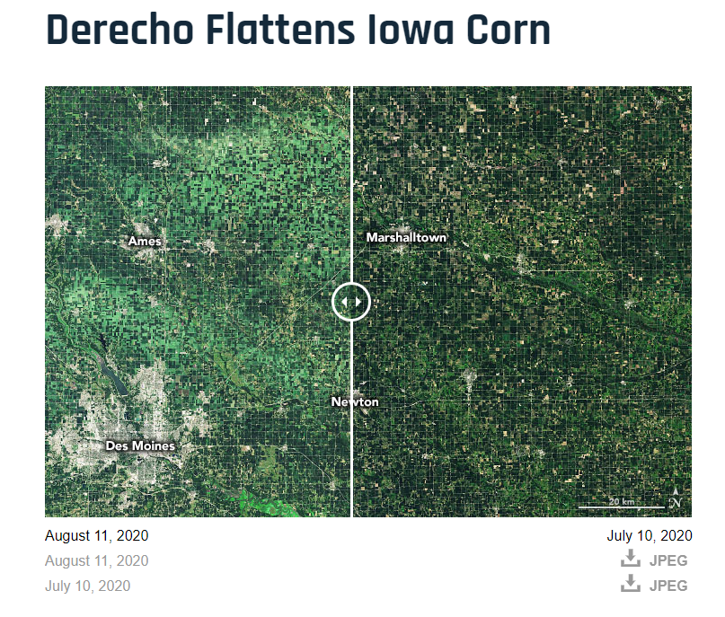
Have you visited the NASA’s Earth Observatory? It is a NASA website that helps make satellite imagery relevant to the general public and it is a great place to find images for presentations or use in the classroom. In August 2020, the Earth Observatory featured a comparison of satellite images from July 2020 and August 2020 to show the extent of the derecho damage on Iowa cropland.
Each week NASA’s Landsat Science team will explore a unique aspect of Landsat earth science (see themes below). Weekly features include Landsat related crafts and games, revisiting each sequential Landsat mission as well a weekly postcard from camp. Stop by each week of camp to explore a new theme.