
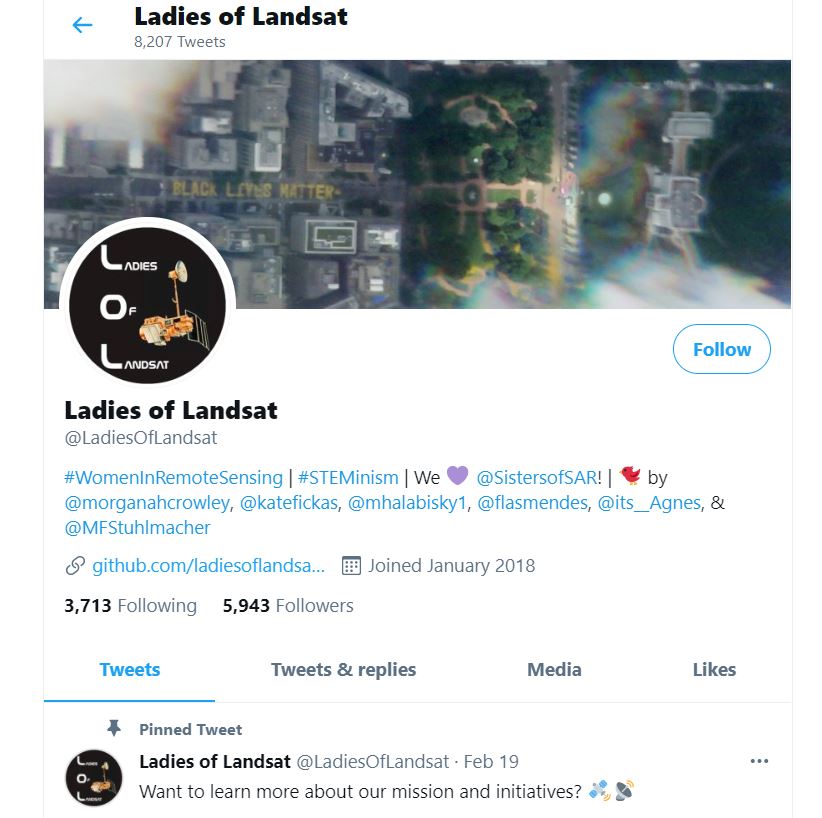
Ladies of Landsat
Here’s a short video created by USGS featuring the Ladies of Landsat, a twitter-based women’s Landsat science networking group.
Click on the image below to check out the latest on their twitter page.
Here’s a short video created by USGS featuring the Ladies of Landsat, a twitter-based women’s Landsat science networking group.
Click on the image below to check out the latest on their twitter page.
“I have seen further by standing on the shoulders of giants.” ~ Sir Isaac Newton

This week is the virtual American Society for Photogrammetry and Remote Sensing (ASPRS) conference. At today’s conference, the ASPRS Lifetime Achievement Award was presented to Virginia T. Norwood.
Virginia Norwood is known as the “Mother of Landsat.” When interviewed by Laura Rocchio for a NASA Landsat Science article, Ms. Norwood was asked if she is comfortable with this title and she replied, “Yes. I like it, and it’s apt. I created it. I birthed it; and I fought for it.” In recognition of her contributions to satellite communications and optics for over 40 years, including the design, building, promotion and operation of the first multspectral scanner (MSS) on-board Landsat-1, Ms. Norwood was awarded the 2021 ASPRS Lifetime Achievement Award.
To learn more about Virginia’s story: https://landsat.gsfc.nasa.gov/article/virginia-t-norwood-mother-landsat
Congratulations, Virginia! Thank you for all your contribution to Landsat and Science!
Happy Earth Observation Day!
Today we are celebrating remote sensing, the study of the earth using secondary observations from instruments such as planes, kites, drones, satellites as an exciting and powerful educational tool to help us show changes over time.
This year the AmericaView/NASA team has put together a fun and beautiful educational poster!


This week marks 40 years since the Mount St. Helens eruption. The image above is from the USGS Earthshots trading card series. The images are displayed in color infrared which is useful for showing living vegetation in red. The mountains surrounding Mount St. Helens are primarily forest. Notice the extreme change in the landscape from the 1973 image to the post eruption image in 1983. The damage was extensive and ash covered much of the surrounding forest land.

Additional Resource
Earthshots: Satellite Images of Environmental Change – Mount St. Helens: https://earthshots.usgs.gov/earthshots/Mount-St-Helens#ad-image-0-0
Scroll through the images to watch the forest begin to return as the years go by!
Google Earth Engine is a platform for exploring and analyzing satellite imagery. It is available for academic, non-profit, business and government users.
Several members of the AmericaView community have created tutorials to provide a foundation to quickly begin learning and using Google Earth Engine (GEE). If you are new to GEE, you will want to start with this Google Earth Outreach tutorial. You may need to sign-up for a GEE account with an existing Gmail email address.
For a list of additional tutorials visit the AmericaView GEE Tutorial page: https://americaview-old.ssec.wisc.edu/program-areas/education/google-earth-engine-tutorials/.
Gregg Hadish gave a great presentation about the Iowa Geographic Map Server to celebrate Earth Observation Day. It was a hands-on demonstration of the Iowa Geographic Map Server ArcGIS App which meant participants could follow along as he explained the various features and functions of the map server. Gregg also showed participants how to leverage map server layers within their own ArcGIS Online organizational accounts and basics for creating their own apps.
Thank you, Gregg for a great demo!
Here are some pictures from our Earth Observation Day event.
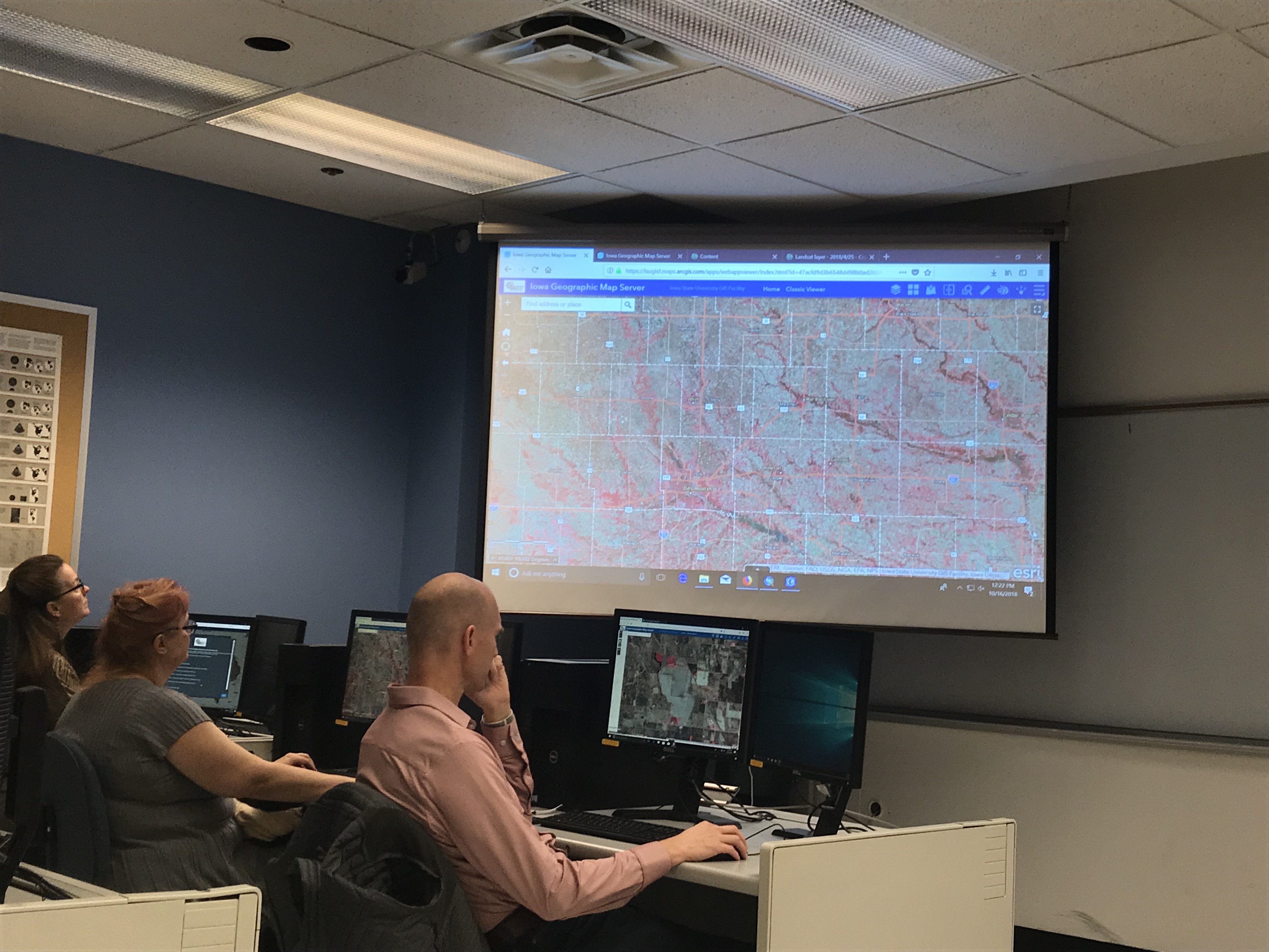
Checking out the new statewide 1 ft color infrared imagery in the web app.
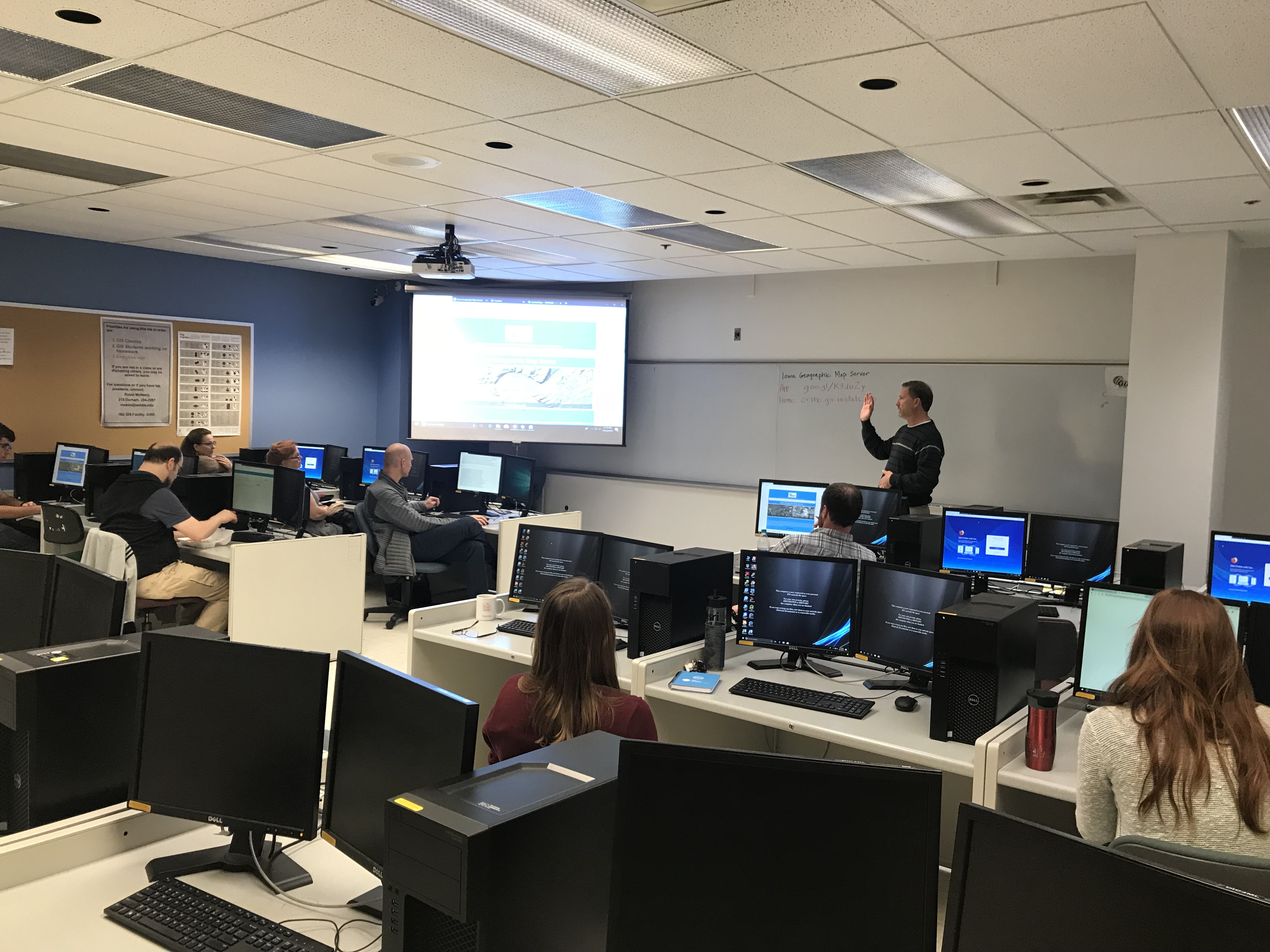
Gregg giving an introduction to the Iowa Geographic Map Server.
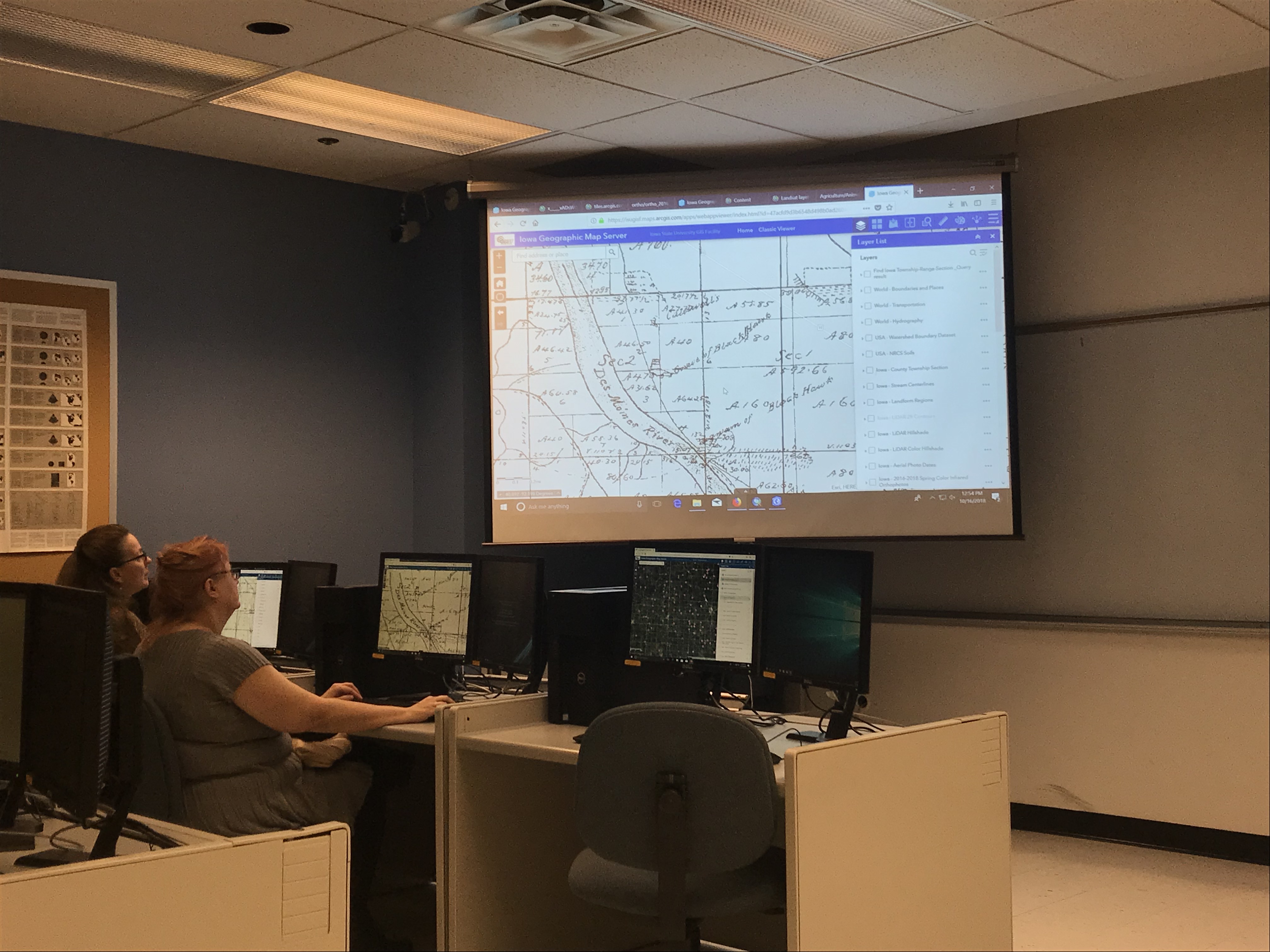
Showing a historical layer – 1880s Andreas Atlas.
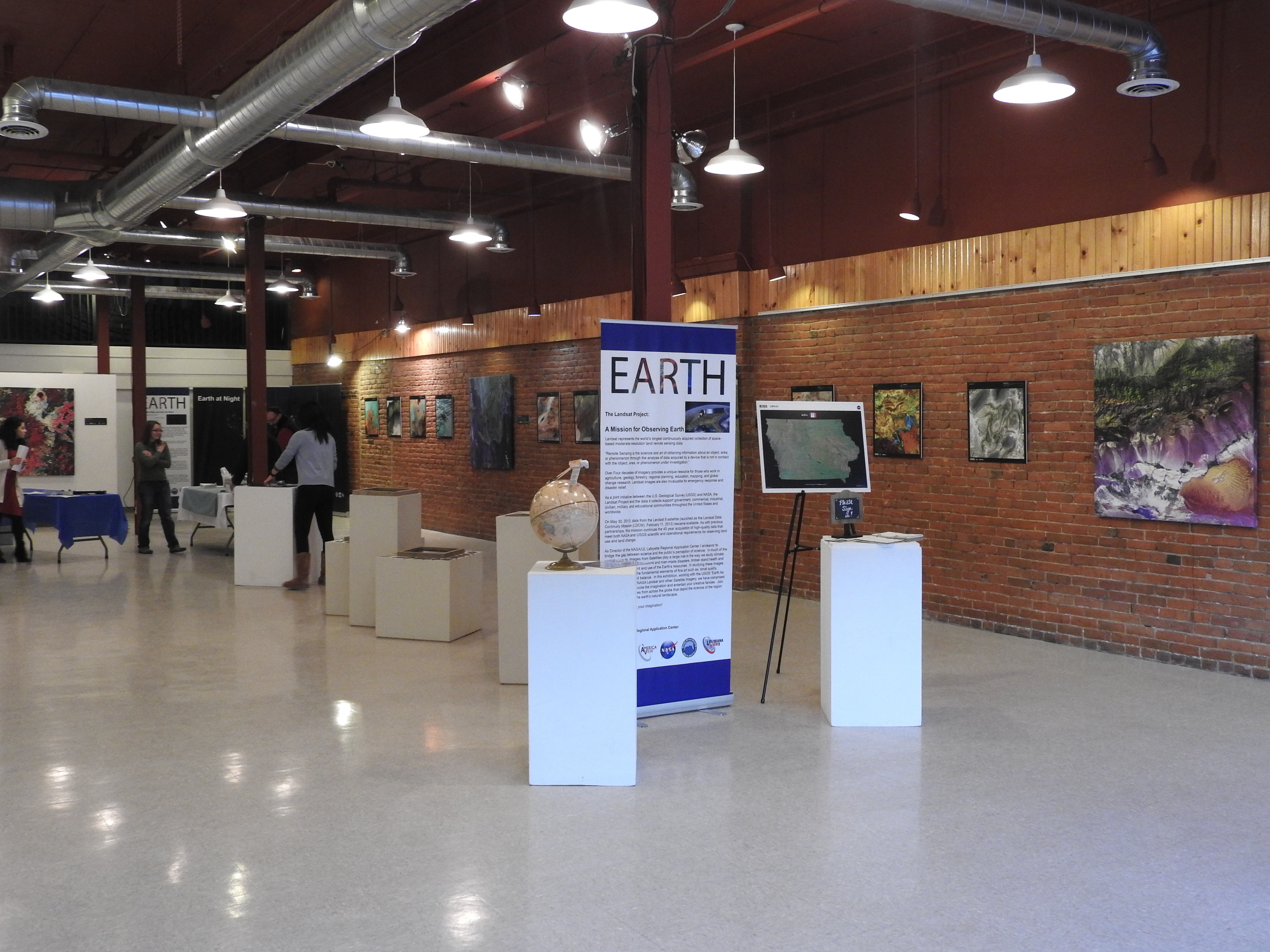
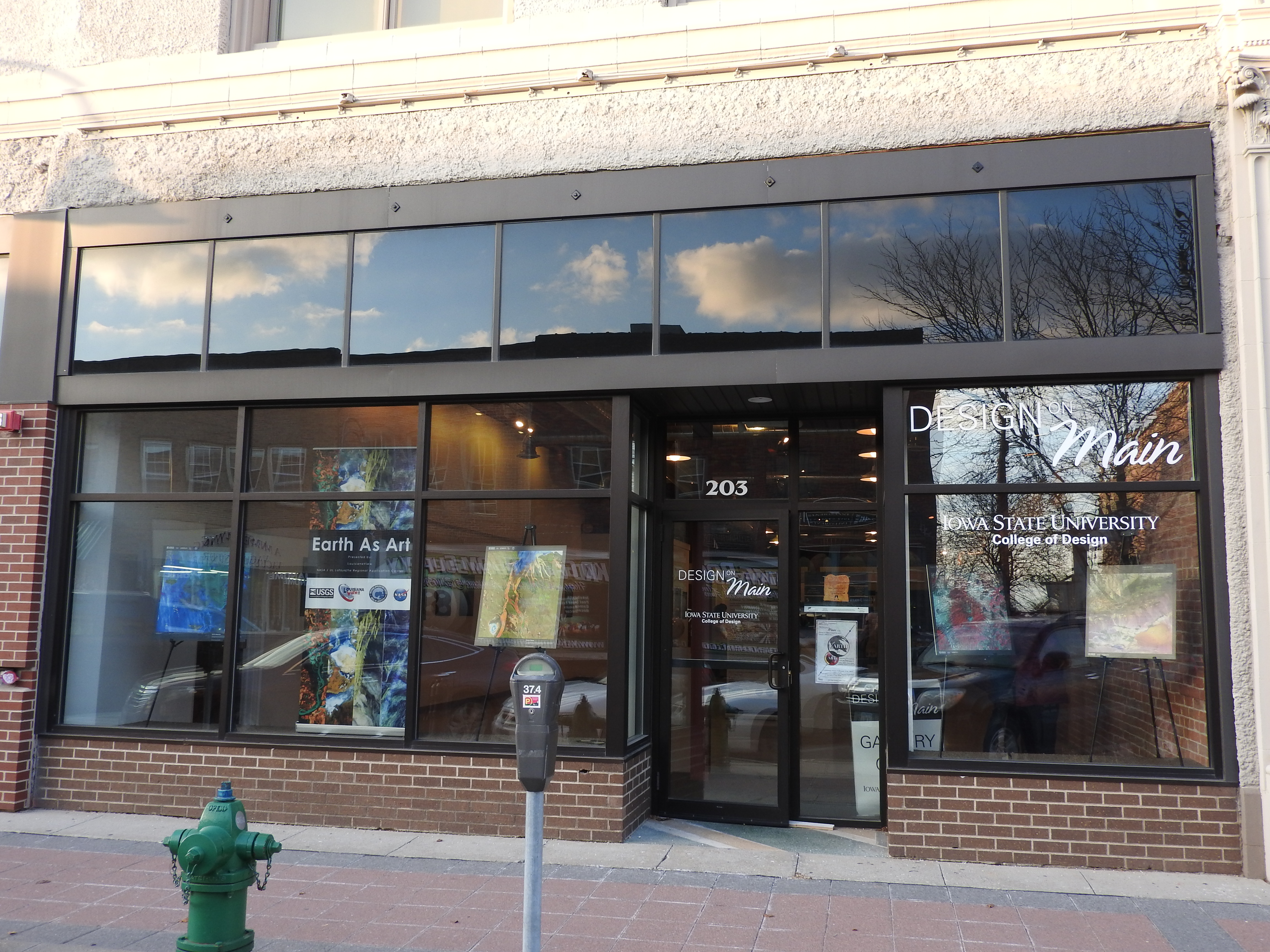
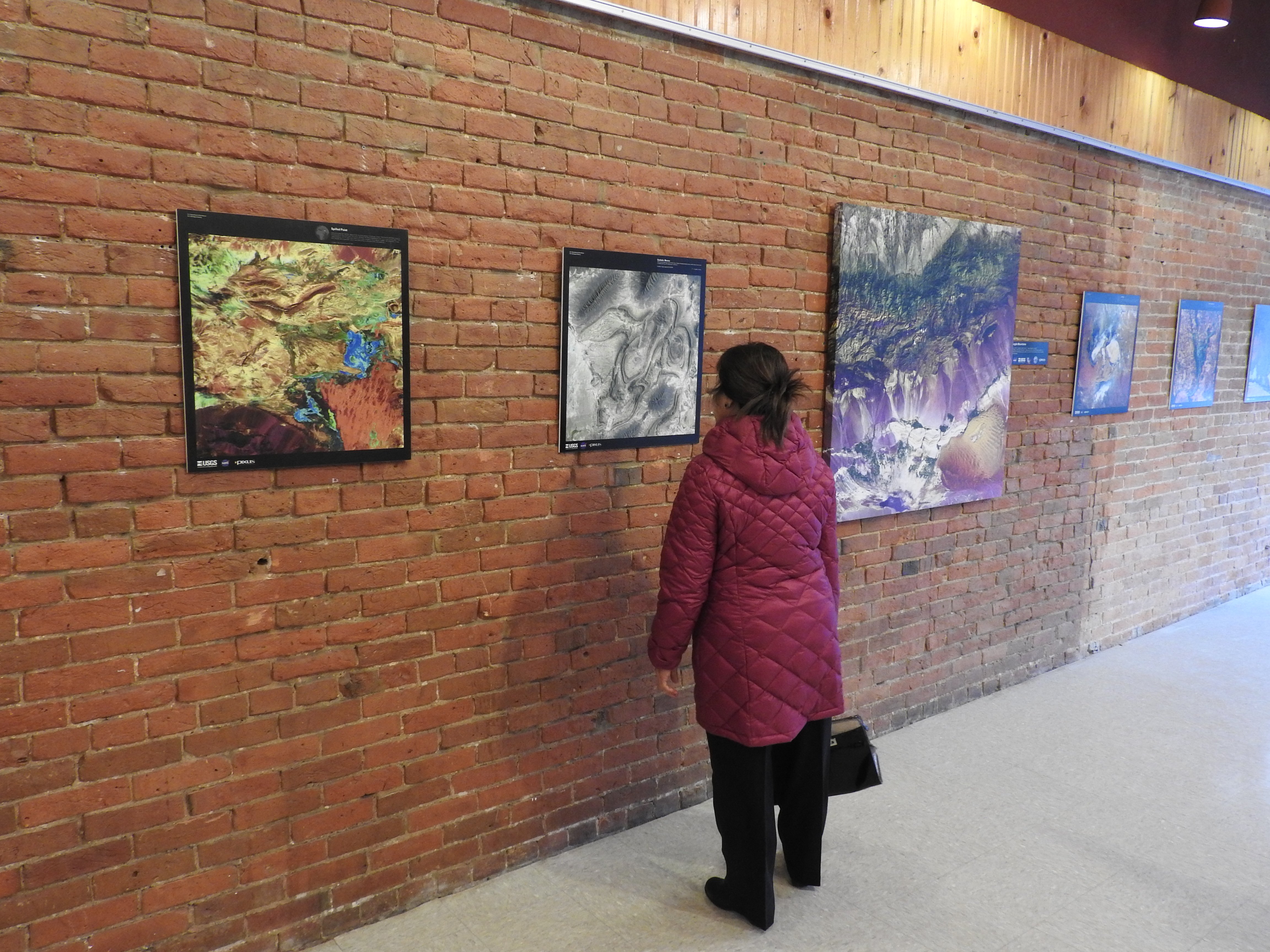 Don’t miss your chance. This is a unique opportunity to see a melding of art, science, geography, and technology here in the Ames community. Come see some great art.
Kids and adults can stop in to make a color wheel or model of a Landsat satellite or search the images to complete the scavenger hunt. The exhibit is running through Sunday, February 26, 2017.
Hours:
Thursday 4-7 pm; Friday 2-5 pm; Saturday 11 am -5 pm
Sunday Feb 19 & 26, 2-5 pm
Read more about the exhibit HERE.
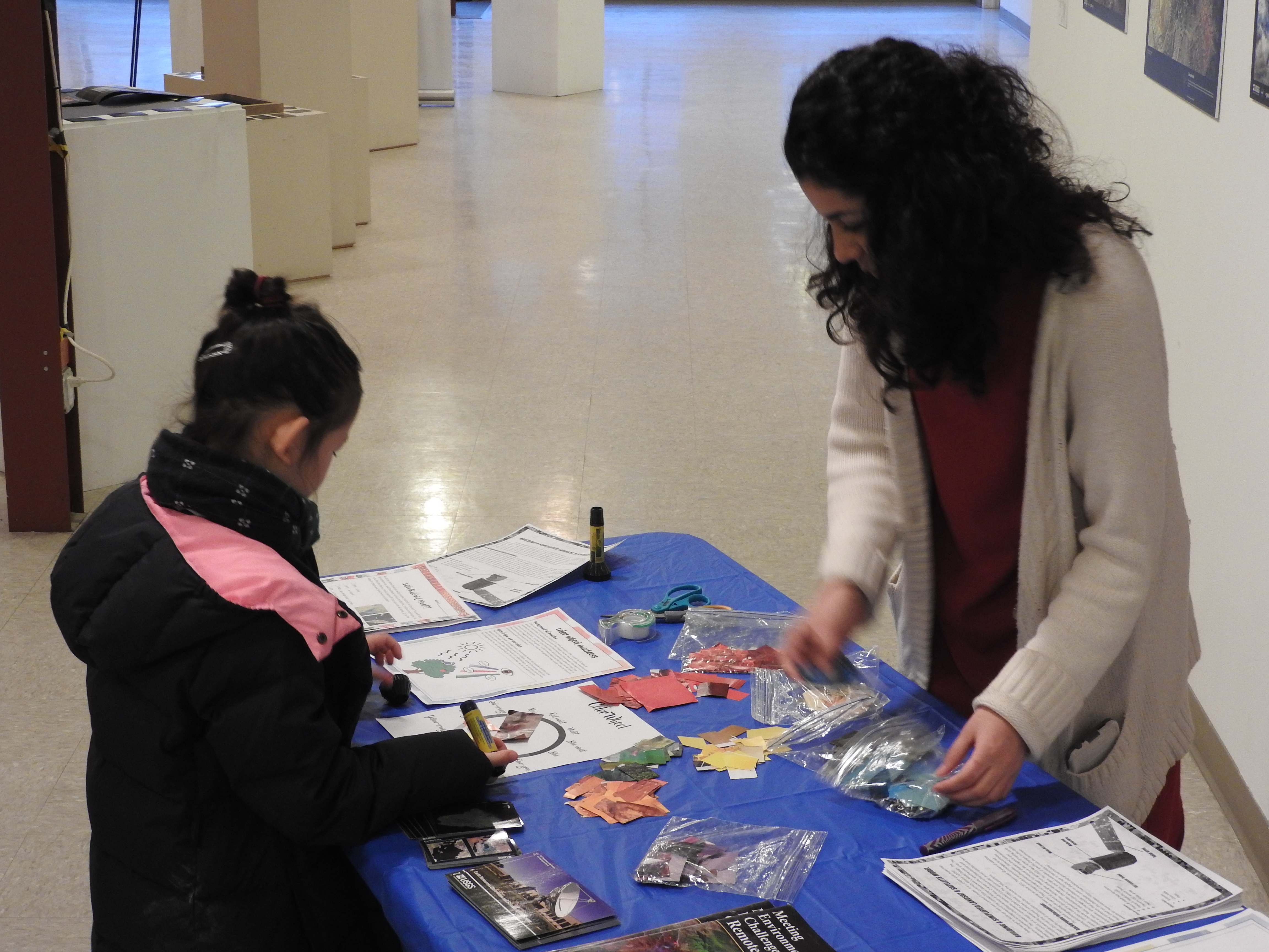
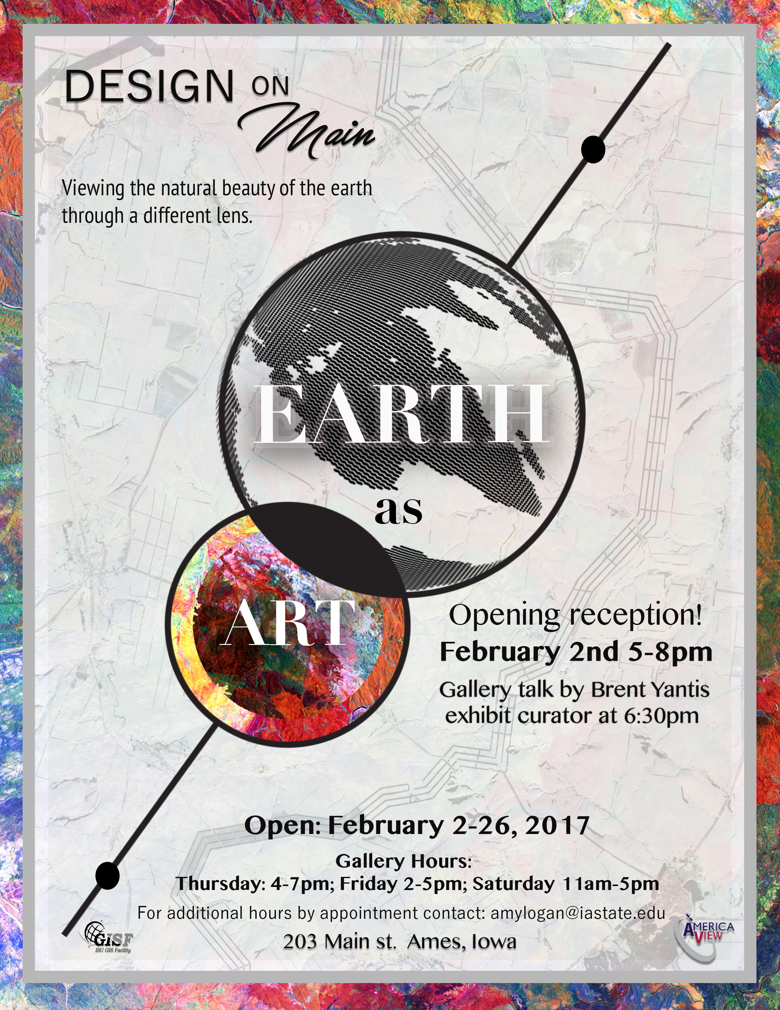
The opening reception for the Earth as Art exhibit is on February, 2, 5-8pm. Several younger visitors were in attendance. They created model satellites, color wheels, and searched the gallery to complete the scavenger hunt. There was gallery talk at 6:30 pm by Brent Yantis, the LouisianaView director and the exhibit collection curator, he explained how the images were selected and shared some of his favorite images with us.


There was a reception of crudites and cheese as well as a King Cake that was brought from Louisiana. The King Cake tasted like a cross between a glazed doughnut and a cinnamon roll, filled with chocolate and cream filling. LouisianaView and IowaView are part of the larger AmericaView, nationwide consortium for remote sensing education, research, and geospatial applications.
IowaView and ISU GIS Facility will be hosting an art exhibit in the Design on Main gallery in February. It will be a unique exhibit that is a fusion of art and science – we hope that the exhibit will inspire viewers with beautiful images from around our planet and also provide a platform for education (satellite imagery, geography, earth science, physics, and art.)
The opening reception for the exhibit is on February, 2, 5-8pm. We are planning to have a gallery talk at 6:30pm by Brent Yantis, the AmericaView collection curator as well as refreshments. AmericaView is a nationwide consortium for remote sensing education, research, and geospatial applications. For additional details visit our Earth as Art exhibit page.

This is a fun service project. Come meet some new people, do some good (mapping) and eat pizza!
MLK Jr. Day OSM Mapping Party Monday January, 16, 2017 from 10 am to 1pm, Durham 206 –
Please RSVP: iowamapgive@gmail.com.
Click here for more information.