
Iowa BMP Mapping Project Website
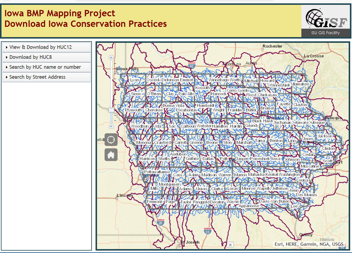
Have you seen this online tool for downloading conservation practices by watershed in Iowa?
Check out the online tool: https://bensonvip.gis.iastate.edu/ISU/BMP/BMP.html
Have you seen this online tool for downloading conservation practices by watershed in Iowa?
Check out the online tool: https://bensonvip.gis.iastate.edu/ISU/BMP/BMP.html

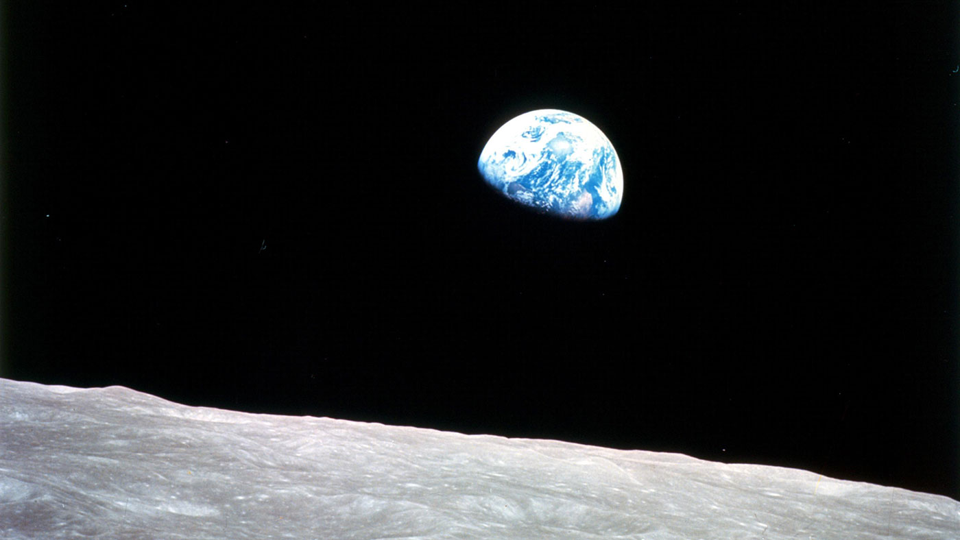
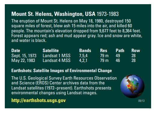
This week marks 40 years since the Mount St. Helens eruption. The image above is from the USGS Earthshots trading card series. The images are displayed in color infrared which is useful for showing living vegetation in red. The mountains surrounding Mount St. Helens are primarily forest. Notice the extreme change in the landscape from the 1973 image to the post eruption image in 1983. The damage was extensive and ash covered much of the surrounding forest land.

Additional Resource
Earthshots: Satellite Images of Environmental Change – Mount St. Helens: https://earthshots.usgs.gov/earthshots/Mount-St-Helens#ad-image-0-0
Scroll through the images to watch the forest begin to return as the years go by!
The Octagon Art Center did a great post around the theme of maps. Enjoy reading with live links here: https://www.facebook.com/OctagonCenterfortheArts/photos/a.255499597795221/3209775222367629/?type=3&theater

Google Earth Engine is a platform for exploring and analyzing satellite imagery. It is available for academic, non-profit, business and government users.
Several members of the AmericaView community have created tutorials to provide a foundation to quickly begin learning and using Google Earth Engine (GEE). If you are new to GEE, you will want to start with this Google Earth Outreach tutorial. You may need to sign-up for a GEE account with an existing Gmail email address.
For a list of additional tutorials visit the AmericaView GEE Tutorial page: https://americaview-old.ssec.wisc.edu/program-areas/education/google-earth-engine-tutorials/.
This Wednesday (April 22, 2020) will mark the 50th anniversary of Earth Day. While many of the large scale celebrations will have to be postponed; here are some ideas for ways to celebrate in your home or neighborhood.
#EarthDayAtHome with NASA – this website has a great collection of activities to explore our world. Here are a few that you might want check out: Terrestrial Tournament (vote for your favorite Earth images), Hit the Bricks (instructions for creating LEGO models Model 1 and Model 2), NEMO-NET (mapping coral reefs), download the ebook “Earth at Night” to view amazing images of our planet at night.
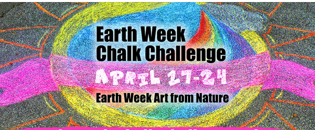
Water Rocks!, an Iowa based water education campaign, has two exciting Earth Week art contests.
1) Create a sidewalk chalk masterpiece showing your love for natural resources or ways to help protect planet Earth.
2) Gather interesting objects you find outside to create art from nature!
Check out the Water Rocks website for full details: https://www.waterrocks.org/.

ISU’s Live Green Monthly Newsletter is also another resource to find ideas for celebrating Earth Day. It is filled with practical tips for living more sustainably, fun DYI Green activities, opportunities for living green as well as other interesting articles.
Have a happy Earth Day!
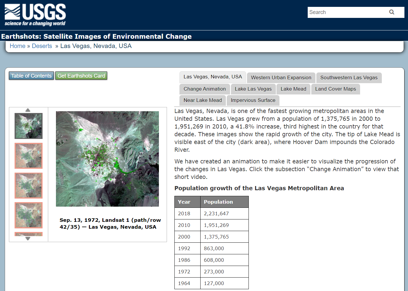
The USGS has produced an amazing collection of images (also available as trading cards!) that show Earth’s change over time. The Earthshot collection has a wide variety of examples of change over time including:
– natural phenomena changes (glaciers, deserts,)
– social change (city growth,)
– human interaction with the natural world (mining, deforestation, agriculture,)
– natural disasters (hurricanes, tornado damage, flooding.)
Below are two examples of the trading cards, Mount St. Helens pre/post volcanic explosion and Las Vegas, Nevada population growth over time.


If you view a location on through the browser you will get about 5 images you can review as well as context about the images.
Other Resources: Tracking Change Over Time (teacher guide): https://pubs.usgs.gov/gip/133/pdf/tracking-packet_web.pdf
Lesson Plan – Investigating Deforestation Throught An Earth Systems View Using Landsat: https://mynasadata.larc.nasa.gov/lesson-plans/investigating-deforestation-through-earth-systems-view-using-landsat
IowaView has trading cards available. Please contact Amy Logan for more information.
AmericaView College-Level Remote Sensing Resources
GeorgeView – AmericaView University
Website: http://gaview.org/moodle30f/
IowaView – GIS and Mapping Task Sheets
Website: https://www.extension.iastate.edu/communities/gis/quicktasksheets
MinnesotaView – Remote Sensing 101
Website: https://minnesotaview.rs.umn.edu/education
MontanaView – Python and R
Website: http://www.montana.edu/montanaview/
NewHampshireView – Remote Sensing Webinars
Website: http://www.nhview.unh.edu/educations_webinars.html
VirginiaView – Remote Sensing Tutorials
Website: https://www.virginiaview.cnre.vt.edu/education.html
WestVirginiaView – Intro to GIS and R Courses
Website: http://www.wvview.org/course_directory.html
VermontView – Youtube Videos – Intro to GIS and Remote Sensing
Website: https://www.youtube.com/user/joneildunne/videos
AmericaView – Google Earth Engine Tutorials
Website: https://americaview.org/program-areas/education/google-earth-engine-tutorials/
AmericaView – Educational Resource Portal
Website: https://americaview.org/program-areas/education/resources/