 Recently, the ISU GIS Facility, in partnership with AmericaView, hosted two workshops as part of the 2017 Iowa 4-H State Conference, “Start Your Future Here.” This conference is a good opportunity for students to try something new. This was the third year that IowaView has participated in the 4-H conference. For many 4-Hers, this was their first experience with mapping and GIS. We offered two different workshops this year. One workshop was focused on GIS and mapping using the ESRI platform and the other workshop was focused on learning to use Open Street Map for assisting with humanitarian projects.
The first workshop, “Start Your Mapping Adventure Here,” was an introduction to GIS and mapping. During the session students were presented with the basics of GIS and creating a map. Then 4-Hers were able to complete several hands-on project to illustrate various mapping products.

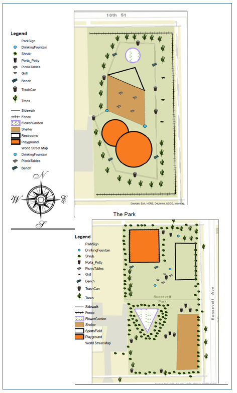
Examples of Park Map Designs
Students used ArcGIS Online to interact with and make sense of a news article about the migration crisis from Tunisia to the Italian island of Lampedusa. They learned how to use tools in ArcGIS Online to answer question related to the article. Some of the tools they explored included the Find box to quickly navigate to places on the map, map notes to mark locations on the map, and how to change basemap imagery to reveal different facets of a place by examining topography and photography. This exercise was based on an exercise found in an ESRI teacher training: “Teaching with GIS: Introduction to Using GIS in the Classroom.”
Next participants were divided into small groups and tasked with using ArcMap desktop to create a map of a new city park which they were asked to design. Through this exercise students learned how to navigate desktop, edit and remove features and then create a map and map properties (legend, north arrow, title.) See examples of their maps to the right. The idea for this exercise came from materials put out by the National 4-H Council as part of a 2013 National Youth Science Day: Maps and Apps Activities. The exercise suggested having students manually create layers on paper but we wanted to infuse the activity with technology and introduce 4-Hers to ArcMap.
Finally, we explored several Story Maps from a very basic map to a multi-media interactive map. Here are two other great Story Maps examples showing to additional styles: the spyglass and cascade. This gave the 4-Hers exposure to another mapping medium and possibly a way to display data for school projects or 4-H projects.
To learn more about the 4-H conference, check out this link to an article from the Alliance for Iowa State: State 4-H Conference Offers Teens a Complete Iowa State Experience, 6/28/2017.
