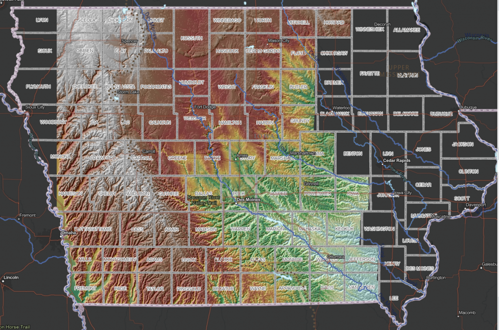
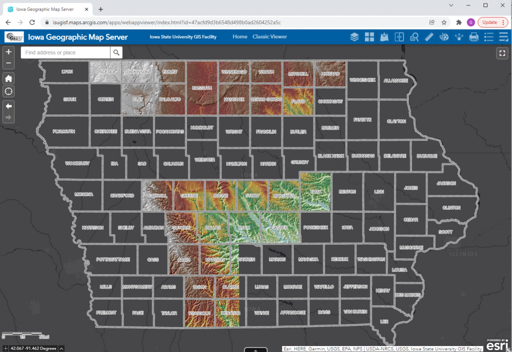
More progress made on the 2020 LiDAR release (Western Iowa)
Six additional counties in western Iowa have been added to the 2020 LiDAR service: https://arcg.is/15eHuH0

Six additional counties in western Iowa have been added to the 2020 LiDAR service: https://arcg.is/15eHuH0

Web services providing 2020 LiDAR for more of the state have been published. To date about 28 counties have been completed.


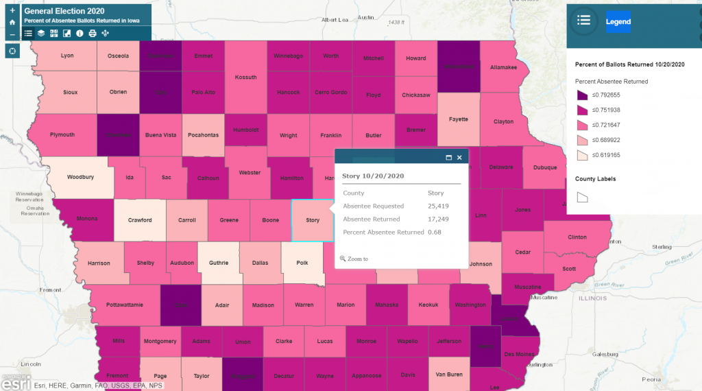
Happy Wednesday! Here is a map from the Iowa State University Extension Community and Economic Development showing the percent of absentee ballots returned in Iowa by county. There is also a layer that shows percentage of absentee ballots returned by party. This map will be updated regularly as we move towards the election.
https://isugisf.maps.arcgis.com/apps/View/index.html?appid=10a34b747f0f409a8c613ff869c933c9