Tag Archives: Outreach

GIS Day 2021 – Success!

Here are photos from yesterday’s GIS Day event. We had over 50 visitors stop by our table in the ISU College of Design lobby for information about undergraduate minor in GIS and graduate GIS certificate, cupcakes, posters, trading cards and to help put our map puzzles together.

GIS Day @ ISU!!! Wednesday, November 17 2-4pm College of Design Main Lobby

Join the ISU Geographic Information Systems Support and Research Facility to celebrate GIS Day! Enjoy themed cupcakes and poster and trading card giveaways, and learn more about the Geographic Information Science minor and GIS graduate certificate program.

The event will be from 2–4 p.m. Wednesday, Nov. 17, in the foyer inside the main entrance to the College of Design.

https://www.design.iastate.edu/event-listings/2021/11/gis-day-celebration/

Join in the celebration of Geography Awareness Week 2021!

November 14-20, 2021

Geography Awareness Week is coming soon. We will be sharing information about GIS and geography related careers as well as activities and games to help you sharpen your geography and geospatial skills throughout the week. Check IowaView daily for a new topic.

The History of Geography Awareness Week:

The National Geographic Society created Geography Awareness Week over 25 years ago as a way to celebrate and raise awareness of geography both as a discipline and as a part of daily life. The National Geographic Society felt there was a dangerous deficiency in American education with limited exposure to geography too many young Americans are unable to make effective decisions, understand geo-spatial issues, or even recognize their impacts as global citizens.
— see more at the National Geographic Website

IowaView Rendezvous at Spirits in the Gardens

On November 1st, IowaView staff participated the “meet-a-scientist” at the annual Reiman Gardens Spirits in the Gardens event featuring a self guided pathway with hundreds of carved pumpkins as well as scientists to meet along the way. During our shift, there were over 250 visitors of all ages. We were able to share posters featuring remote sensing and GIS, which included aerial imagery of Ames and Reiman Gardens dating from the 1930s to 2019. Participants enjoyed seeing change over time as Ames has urbanize over the last ninety years. Staff gave out goodie bags with AmericaView poster, USGS trading cards, and Earth as Art bookmarks and booklets.

Loess Hills: Iowa Landforms Revealed

Obscured from view by vegetation and built structures, Iowa’s often subtle landforms are revealed through a LiDAR-derived bare earth digital elevation model in a Geographic Information System. Geological and human made features can be seen in this series of LiDAR color hillshade maps from across the State.

Loess

Deep deposits of wind-blown silt define the Loess Hills region of western Iowa. Intricate drainage networks and agricultural terraces are visible in this map from along the West Nishnabotna River near Hamburg.

Click on image to explore.
This image is of part of the Loess Hills in southwest Iowa.

Algona Moraine: Iowa Landforms Revealed

Obscured from view by vegetation and built structures, Iowa’s often subtle landforms are revealed through a LiDAR-derived bare earth digital elevation model in a Geographic Information System. Geological and human made features can be seen in this series of LiDAR color hillshade maps from across the State.

Algona

The elevated curved features in this map are glacial moraines deposited during the most recent period of glaciation in north-central Iowa. The largest in this view is called the Algona Moraine.

The Algona Moraine is located in north central Iowa.

Oneota River Valley: Iowa Landforms Revealed

Obscured from view by vegetation and built structures, Iowa’s often subtle landforms are revealed through a LiDAR-derived bare earth digital elevation model in a Geographic Information System. Geological and human made features can be seen in this series of LiDAR color hillshade maps from across the State.

Oneota

Originally called the Oneota, the central river feature in this map is the Upper Iowa River. The well-defined drainage features are characteristic of the Driftless area of northeast Iowa.

Click on the image to explore in detail.
The Oneota River Valley is located in northeastern Iowa.

Coming Soon: Earth Observation Day – Tuesday October 15, 2019

When: Tuesday, October 15, 2019
Where: GIS Teaching Lab, Room 248, Durham Center, Iowa State University, Ames, Iowa

This year the ISU GIS Facility in collaboration with IowaView will be celebrating Earth Observation Day. This year the theme is “Geoscience is Everywhere.” We have a great day planned.

To start out our day at 10:30am, Professor Peter Wolter will share how he is using remote sensing to measure forest structure and composition. Then we will have a Humanitarian Open Street Map Event 11am-12:30pm. No experience is needed. First, we will have an Iowa-Focused activity 11:00am-11:45am and then we will focus our efforts on an international Humanitarian OpenStreetMap activity from 11:45am-12:30pm. We will also have pizza and you are encouraged to try our new puzzles.

REGISTER NOW: https://forms.gle/pDeEHbLY1eEV6Ejq7Ejq7

Introducing Iowa Landforms Revealed

This spring, Gregg Hadish of USDA Natural Resource Conservation Service and staff member of ISU GIS Facility put together a series of images called Iowa Landforms Revealed. The project looks at Iowa geological features using LiDAR. Gregg also used interesting color ramps to give these images an artistic component, inspired by the USGS Earth as Art project. The initial project includes a series of 4 images which debuted at the Iowa Technology And Geospatial (ITAG) Conference in West Des Moines, Iowa, this summer. We will be highlighting each image over the next several weeks as a special series feature on the IowaView blog. Please feel free to leave comments or suggestion for future landforms for us to explore.

Earth Observation Day – October 16, 2018


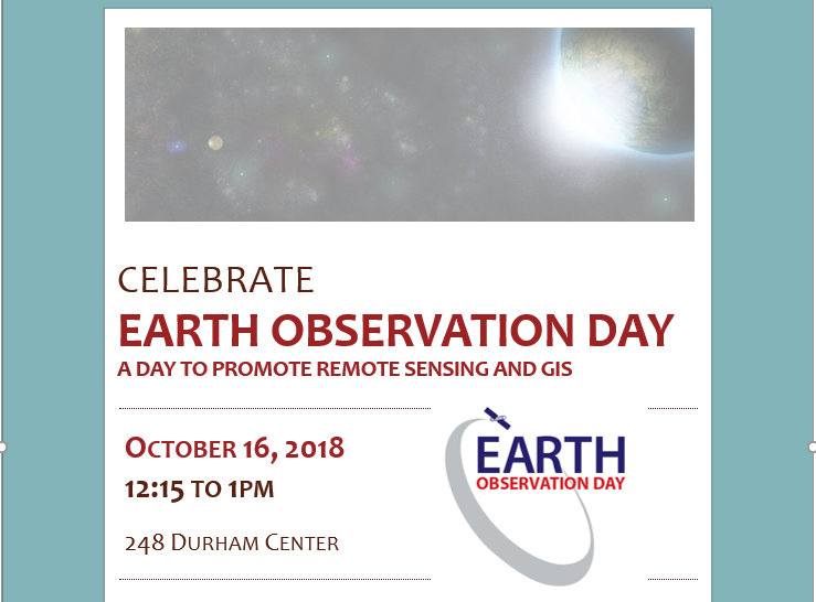
IowaView, in collaboration with ISU GIS Facility and AmericaView, will be hosting the annual Earth Observation Day celebration, Tuesday, October 16, 2018, in Durham 248 from 12:15 to 1pm as part of Earth Science Week.  This year, Gregg Hadish, a staff member of ISU GIS Facility and Iowa NRCS will be our featured speaker; he will give a hands-on demo of the Iowa Geographic Map Server (http://ortho.gis.iastate.edu/.) Iowa Geographic Map Server is browser-based website for statewide Iowa imagery. Gregg has been involved with the development of the Iowa Geographic Map Server for nearly twenty years.  The presentation will highlight recent innovations to the map server including an updated interface as well as many new features and image services. 

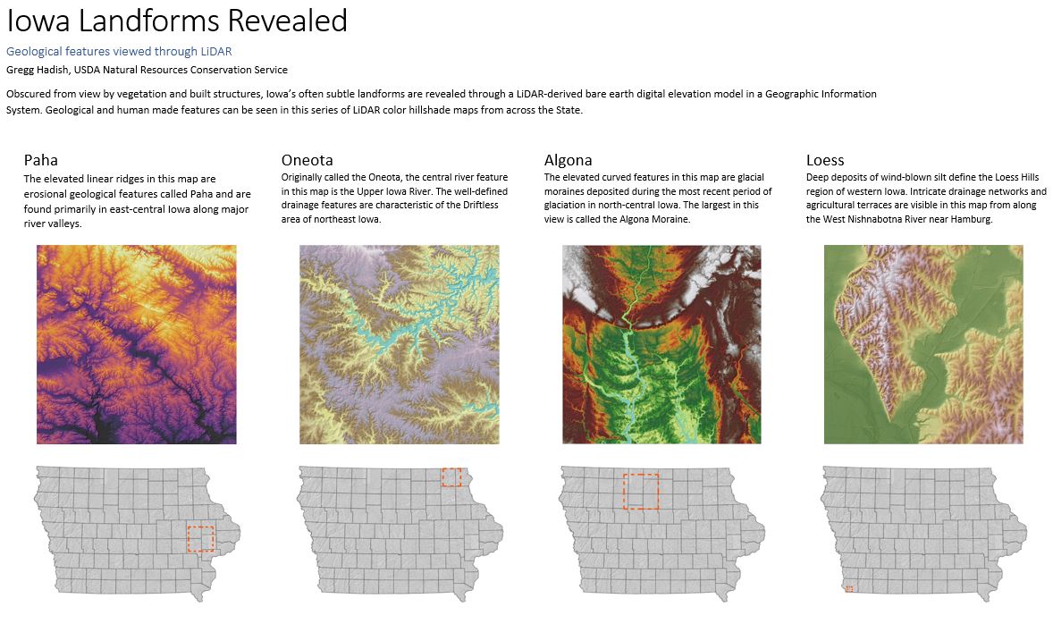
Iowa Geographic Map Server hosts statewide Iowa imagery dating back to the 1930s through spring 2018 as well as layers of elevation data (Lidar hillshade, contours), high-resolution land cover data, and historical data including the 1880s General Land Office maps and Andreas Atlas.  Many of the layers are available as web services within GIS software.  This is one of the most robust, publicly available, spatial imagery datasets in the country. This treasure trove of Iowa imagery that is waiting to be incorporated into your research.  This workshop is for all levels. There will also be time for questions.  If you plan to come, please RSVP with amylogan@iastate.edu as computer space is limited.