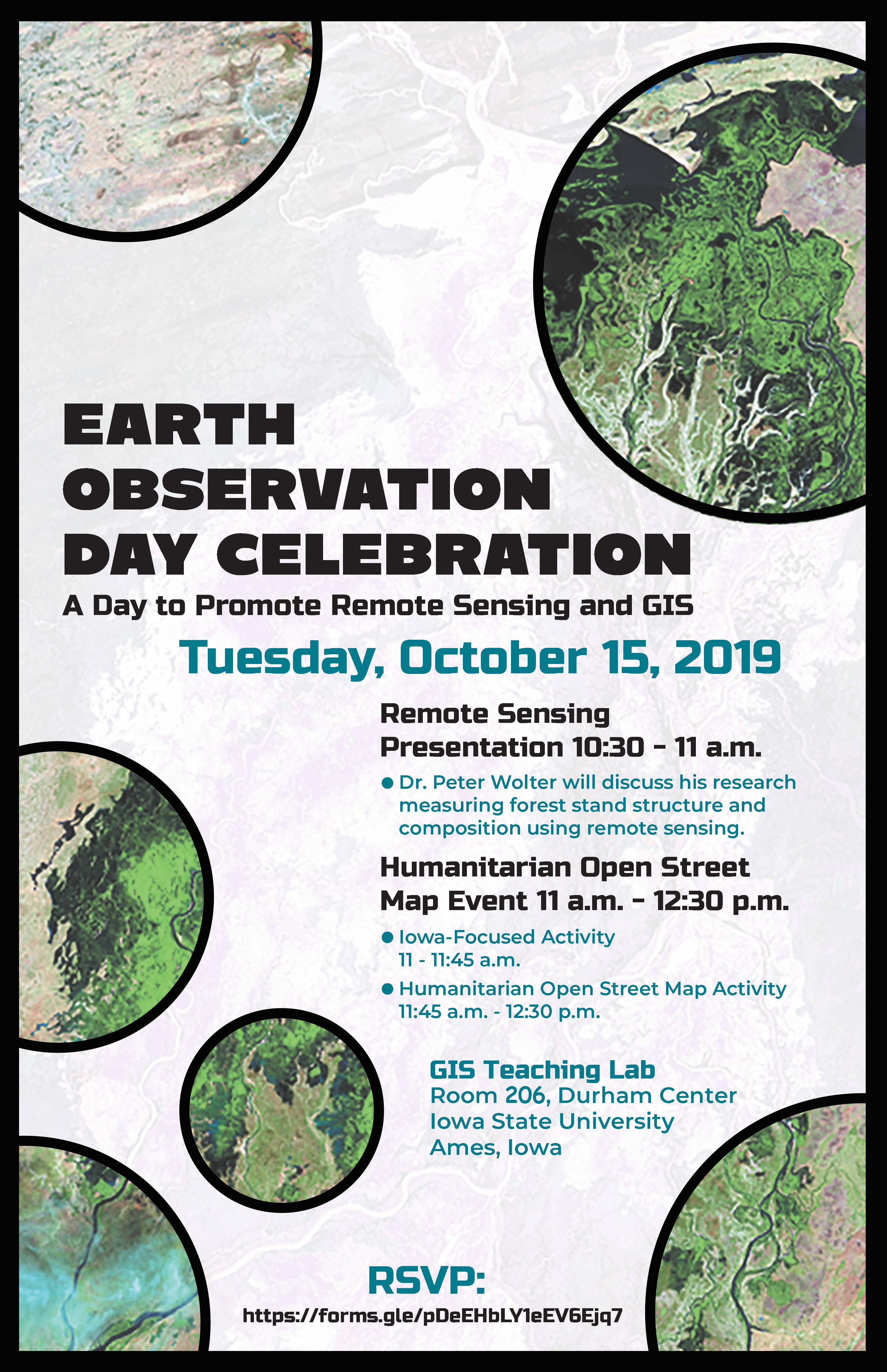
Tag Archives: Remote sensing

#TimeLapse Tuesday – Spot the Change – Urban Growth of Ankeny, Iowa

What changes do you notice in this Landsat time lapse video?

1) The areas of purple and white in the image are urban areas. Throughout the video they fill in the area from the bottom to the center. The pink areas are farm land.

2) Did you notice the increase in the number of retention ponds (dark blue specks in the urban areas) over time? Retention ponds are used to prevent flooding and provide for water storage in urban areas. As areas become urbanized there is often more surface covered in concrete, parking lots and buildings. There are fewer places for the water to flow directly into the ground.

3) Did you spot the golf course on the northern edge of the city?


This year we are celebrating 50 years of the Landsat earth observing satellite mission. Landsat data helps us observe changes in our communities and environment over time.


This video was created using Google Earth Engine. You can create your own time lapse videos by visiting: https://emaprlab.users.earthengine.app/view/lt-gee-time-series-animator.

IowaView Rendezvous at Spirits in the Gardens

On November 1st, IowaView staff participated the “meet-a-scientist” at the annual Reiman Gardens Spirits in the Gardens event featuring a self guided pathway with hundreds of carved pumpkins as well as scientists to meet along the way. During our shift, there were over 250 visitors of all ages. We were able to share posters featuring remote sensing and GIS, which included aerial imagery of Ames and Reiman Gardens dating from the 1930s to 2019. Participants enjoyed seeing change over time as Ames has urbanize over the last ninety years. Staff gave out goodie bags with AmericaView poster, USGS trading cards, and Earth as Art bookmarks and booklets.

Earth Science Week – Day 3: Earth Observation Day

Happy Earth Observation Day!

Today we are celebrating remote sensing, the study of the earth using secondary observations from instruments such as planes, kites, drones, satellites as an exciting and powerful educational tool to help us show changes over time.

This year the AmericaView/NASA team has put together a fun and beautiful educational poster!

Read More

AmericaView Educational Resources – College-Level

AmericaView College-Level Remote Sensing Resources

GeorgeView – AmericaView University
Website: http://gaview.org/moodle30f/

IowaView – GIS and Mapping Task Sheets
Website: https://www.extension.iastate.edu/communities/gis/quicktasksheets

MinnesotaView – Remote Sensing 101
Website: https://minnesotaview.rs.umn.edu/education

MontanaView – Python and R
Website: http://www.montana.edu/montanaview/

NewHampshireView – Remote Sensing Webinars
Website: http://www.nhview.unh.edu/educations_webinars.html

VirginiaView – Remote Sensing Tutorials
Website: https://www.virginiaview.cnre.vt.edu/education.html

WestVirginiaView – Intro to GIS and R Courses
Website: http://www.wvview.org/course_directory.html

VermontView – Youtube Videos – Intro to GIS and Remote Sensing
Website: https://www.youtube.com/user/joneildunne/videos

AmericaView – Google Earth Engine Tutorials
Website: https://americaview.org/program-areas/education/google-earth-engine-tutorials/

AmericaView – Educational Resource Portal
Website: https://americaview.org/program-areas/education/resources/

A Great day for Earth Observation – Part I

Earth Observation Day 2019 was super.

First, Professor Peter Wolter shared with us several projects he has worked on in northern forests of Minnesota, Wisconsin, and Michigan. He explained how he has used multiple satellites/sensors to identify specific traits in trees (wavelength, height, temporal change, etc.) which allowed him to classify different regions of the forest by species. Below are some pictures from his presentation. Thank you, Peter!

Coming Soon: Earth Observation Day – Tuesday October 15, 2019

When: Tuesday, October 15, 2019
Where: GIS Teaching Lab, Room 248, Durham Center, Iowa State University, Ames, Iowa

This year the ISU GIS Facility in collaboration with IowaView will be celebrating Earth Observation Day. This year the theme is “Geoscience is Everywhere.” We have a great day planned.

To start out our day at 10:30am, Professor Peter Wolter will share how he is using remote sensing to measure forest structure and composition. Then we will have a Humanitarian Open Street Map Event 11am-12:30pm. No experience is needed. First, we will have an Iowa-Focused activity 11:00am-11:45am and then we will focus our efforts on an international Humanitarian OpenStreetMap activity from 11:45am-12:30pm. We will also have pizza and you are encouraged to try our new puzzles.

REGISTER NOW: https://forms.gle/pDeEHbLY1eEV6Ejq7Ejq7

AmericaView’s YouTube videos rock!

Are you new to remote sensing? Are you moving from using ArcGIS Desktop to ArcGIS Pro? Would you like to learn how to better use E-Cognition?

Jarlath O’Neil-Dunne, a professor at University of Vermont and the Director of Spatial Analysis Laboratory has produced an amazing collection of videos which range in scope for those just beginning in remote sensing and GIS to advanced topics and demonstrations.

Here’s the link to Jarlath’s YouTube channel: https://www.youtube.com/channel/UCZb1tQu3rctbyuUQLa1vWnQ. He writes a blog called Letter from the SAL (Spatial Analysis Laboratory.)